Просмотреть
Добавить
Копировать
Редактировать
Удалить
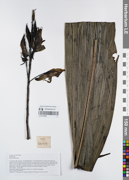
LE 01167592
Phaius tankervilleae (L.Her.) Blume det. Averyanov, Leonid Vladimirovich at 04.05.2000
Коллекторы: Averyanov, Leonid Vladimirovich; et al. Полевой номер образца: VH6069. Дата сбора: 04.05.2000. Административные регионы: VN - Tinh GJak Lak. Группы образцов: L. V. Averyanov specimens; L. V. Averyanov herbarium; Orchids of Vietnam, Laos and CambodiaТекст оригинальной этикетки:FLORA OF VIETNAM
Координаты: 12° 30′ N, 108° 30′ E ±1000 mСоздание записи: 2022-03-03, Galina Savich, PhotoScan D2. Статус обработки: work_status_1Цитирование: Образец LE 01167592 // Виртуальный гербарий Ботанического института им. В. Л. Комарова РАН — http://rr.herbariumle.ru/01167592Orchidaceae
Phaius tankervilliae
S. Vietnam, Dak Lac Prov., Krong Bong Distr., Cu Pui Municipality, elevation from Dak Tour village (12°30′N, 108°30′E) to main peak of Chu Yang Sinh mt system (12°24′N, 108°26′E) along Dak Tour river (N slope). Primary wet closed mountain broad-leaved forest on granites along river slopes at elev. 500-900 m. Terrestrial herb up to 1 m hg in open grassy forest swamp. Flowers: tepals white, with dirty purple tint, lip purple with yellowish margin. Common.
VH 6069 04.05.2000
International Botanical Expedition of the U.S.A. National Geographic Society (grant No 6383-98)
Collectors: L.Averyanov, N.T.Hiep, N.Q.Hieu, P.H.Hoang, D.X.Du, N.T.Vinh
Phaius tankervilliae
S. Vietnam, Dak Lac Prov., Krong Bong Distr., Cu Pui Municipality, elevation from Dak Tour village (12°30′N, 108°30′E) to main peak of Chu Yang Sinh mt system (12°24′N, 108°26′E) along Dak Tour river (N slope). Primary wet closed mountain broad-leaved forest on granites along river slopes at elev. 500-900 m. Terrestrial herb up to 1 m hg in open grassy forest swamp. Flowers: tepals white, with dirty purple tint, lip purple with yellowish margin. Common.
VH 6069 04.05.2000
International Botanical Expedition of the U.S.A. National Geographic Society (grant No 6383-98)
Collectors: L.Averyanov, N.T.Hiep, N.Q.Hieu, P.H.Hoang, D.X.Du, N.T.Vinh
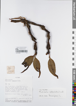
LE 01167591
Pholidota articulata Lindl. det. Averyanov, Leonid Vladimirovich at 28.02.2022
Коллекторы: Averyanov, Leonid Vladimirovich; et al. Полевой номер образца: VH5685. Дата сбора: 23.04.2000. Административные регионы: VN - Kon Tum. Группы образцов: L. V. Averyanov specimens; L. V. Averyanov herbarium; Orchids of Vietnam, Laos and CambodiaТекст оригинальной этикетки:FLORA OF VIETNAM
Координаты: 14° 39′ N, 108° 25′ E ±1000 mСоздание записи: 2022-03-03, Galina Savich, PhotoScan D2. Статус обработки: work_status_1Цитирование: Образец LE 01167591 // Виртуальный гербарий Ботанического института им. В. Л. Комарова РАН — http://rr.herbariumle.ru/01167591Orchidaceae
Pholidota recurva ?
S. Vietnam, Kontum Prov., Kon Plong Distr., Hieu Municipality, Mang La forest enterprise (14°39′N, 108°25′E). Primary broad-leaved closed evergreen wet mountain forest on sandstone steep slopes of forest river at elev. 1100-1200 m. Epiphyte on high trees. Not common.
VH 5685 24.04.2000
International Botanical Expedition of the U.S.A. National Geographic Society (grant No 6383-98)
Collectors: L.Averyanov, P.H.Hoang, D.X.Du, N.T.Vinh
Pholidota recurva ?
S. Vietnam, Kontum Prov., Kon Plong Distr., Hieu Municipality, Mang La forest enterprise (14°39′N, 108°25′E). Primary broad-leaved closed evergreen wet mountain forest on sandstone steep slopes of forest river at elev. 1100-1200 m. Epiphyte on high trees. Not common.
VH 5685 24.04.2000
International Botanical Expedition of the U.S.A. National Geographic Society (grant No 6383-98)
Collectors: L.Averyanov, P.H.Hoang, D.X.Du, N.T.Vinh
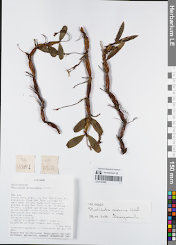
LE 01167590
Pholidota recurva Lindl. det. Averyanov, Leonid Vladimirovich at 28.02.2022
Коллекторы: Averyanov, Leonid Vladimirovich; et al. Полевой номер образца: VH6261. Дата сбора: 07.05.2000. Административные регионы: VN - Tinh GJak Lak. Группы образцов: L. V. Averyanov specimens; L. V. Averyanov herbarium; Orchids of Vietnam, Laos and CambodiaТекст оригинальной этикетки:FLORA OF VIETNAM
Координаты: 12° 30′ N, 108° 30′ E ±1000 mСоздание записи: 2022-03-03, Galina Savich, PhotoScan D2. Статус обработки: work_status_1Цитирование: Образец LE 01167590 // Виртуальный гербарий Ботанического института им. В. Л. Комарова РАН — http://rr.herbariumle.ru/01167590Orchidaceae
Pholidota articulata ?
S. Vietnam, Dak Lac Prov., Krong Bong Distr., Cu Pui Municipality, elevation from Dak Tour village (12°30′N, 108°30′E) to main peak of Chu Yang Sinh mt system (12°24′N, 108°26′E) along Dak Tour river (N slope). Primary closed wet broad-leaved and mixed forest (with Pinus, Fokienia, Dacrydium and Dacrycarpus) on steep granite slopes at elev. 1550 m. Epiphyte on high trees. Not rare.
VH 6261 07.05.2000
Pholidota articulata ?
S. Vietnam, Dak Lac Prov., Krong Bong Distr., Cu Pui Municipality, elevation from Dak Tour village (12°30′N, 108°30′E) to main peak of Chu Yang Sinh mt system (12°24′N, 108°26′E) along Dak Tour river (N slope). Primary closed wet broad-leaved and mixed forest (with Pinus, Fokienia, Dacrydium and Dacrycarpus) on steep granite slopes at elev. 1550 m. Epiphyte on high trees. Not rare.
VH 6261 07.05.2000
International Botanical Expedition of the U.S.A. National Geographic Society (grant No 6383-98)
Collectors: L.Averyanov, N.T.Hiep, N.Q.Hieu, P.H.Hoang, D.X.Du, N.T.Vinh
Collectors: L.Averyanov, N.T.Hiep, N.Q.Hieu, P.H.Hoang, D.X.Du, N.T.Vinh
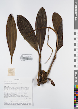
LE 01167589
Pholidota chinensis Lindl. det. Averyanov, Leonid Vladimirovich at 05.05.2000
Коллекторы: Averyanov, Leonid Vladimirovich; et al. Полевой номер образца: VH6018. Дата сбора: 05.05.2000. Административные регионы: VN - Tinh GJak Lak. Группы образцов: L. V. Averyanov specimens; L. V. Averyanov herbarium; Orchids of Vietnam, Laos and CambodiaТекст оригинальной этикетки:FLORA OF VIETNAM
Координаты: 12° 30′ N, 108° 30′ E ±1000 mСоздание записи: 2022-03-03, Galina Savich, PhotoScan D2. Статус обработки: work_status_1Цитирование: Образец LE 01167589 // Виртуальный гербарий Ботанического института им. В. Л. Комарова РАН — http://rr.herbariumle.ru/01167589Orchidaceae
Pholidota chinensis
S. Vietnam, Dak Lac Prov., Krong Bong Distr., Cu Pui Municipality, elevation from Dak Tour village (12°30′N, 108°30′E) along Dak Tour river on N macroslope of Chu Yang Sinh mt system to main peak (12°24′N, 108°26′E). Primary broad-leaved mountain evergreen closed forest on granites along river slopes at elev. 1000-1200 m. Epiphyte on mossy trees along river. Common. VH 6018 05-06.05.2000
International Botanical Expedition of the U.S.A. National Geographic Society (grant No 6383-98)
Pholidota chinensis
S. Vietnam, Dak Lac Prov., Krong Bong Distr., Cu Pui Municipality, elevation from Dak Tour village (12°30′N, 108°30′E) along Dak Tour river on N macroslope of Chu Yang Sinh mt system to main peak (12°24′N, 108°26′E). Primary broad-leaved mountain evergreen closed forest on granites along river slopes at elev. 1000-1200 m. Epiphyte on mossy trees along river. Common. VH 6018 05-06.05.2000
International Botanical Expedition of the U.S.A. National Geographic Society (grant No 6383-98)
Collectors: L.Averyanov, N.T.Hiep, N.Q.Hieu, P.H.Hoang, D.X.Du, N.T.Vinh
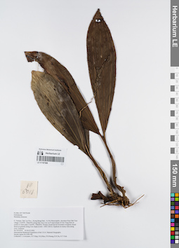
LE 01167588
Pholidota chinensis Lindl. det. Averyanov, Leonid Vladimirovich at 05.05.2000
Коллекторы: Averyanov, Leonid Vladimirovich; et al. Полевой номер образца: VH6018. Дата сбора: 05.05.2000. Административные регионы: VN - Tinh GJak Lak. Группы образцов: L. V. Averyanov specimens; L. V. Averyanov herbarium; Orchids of Vietnam, Laos and CambodiaТекст оригинальной этикетки:FLORA OF VIETNAM
Координаты: 12° 30′ N, 108° 30′ E ±1000 mСоздание записи: 2022-03-03, Galina Savich, PhotoScan D2. Статус обработки: work_status_1Цитирование: Образец LE 01167588 // Виртуальный гербарий Ботанического института им. В. Л. Комарова РАН — http://rr.herbariumle.ru/01167588Orchidaceae
Pholidota chinensis
S. Vietnam, Dak Lac Prov., Krong Bong Distr., Cu Pui Municipality, elevation from Dak Tour village (12°30′N, 108°30′E) along Dak Tour river on N macroslope of Chu Yang Sinh mt system to main peak (12°24′N, 108°26′E). Primary broad-leaved mountain evergreen closed forest on granites along river slopes at elev. 1000-1200 m. Epiphyte on mossy trees along river. Common.
Pholidota chinensis
S. Vietnam, Dak Lac Prov., Krong Bong Distr., Cu Pui Municipality, elevation from Dak Tour village (12°30′N, 108°30′E) along Dak Tour river on N macroslope of Chu Yang Sinh mt system to main peak (12°24′N, 108°26′E). Primary broad-leaved mountain evergreen closed forest on granites along river slopes at elev. 1000-1200 m. Epiphyte on mossy trees along river. Common.
VH 6018 05-06.05.2000
International Botanical Expedition of the U.S.A. National Geographic Society (grant No 6383-98)
Collectors: L.Averyanov, N.T.Hiep, N.Q.Hieu, P.H.Hoang, D.X.Du, N.T.Vinh
Collectors: L.Averyanov, N.T.Hiep, N.Q.Hieu, P.H.Hoang, D.X.Du, N.T.Vinh
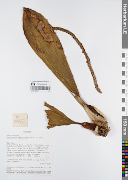
LE 01167587
Pholidota imbricata Lindl. det. Averyanov, Leonid Vladimirovich at 03.05.2000
Коллекторы: Averyanov, Leonid Vladimirovich; et al. Полевой номер образца: VH5965. Дата сбора: 03.05.2000. Административные регионы: VN - Tinh GJak Lak. Группы образцов: L. V. Averyanov specimens; L. V. Averyanov herbarium; Orchids of Vietnam, Laos and CambodiaТекст оригинальной этикетки:FLORA OF VIETNAM
Координаты: 12° 30′ N, 108° 30′ E ±1000 mСоздание записи: 2022-03-03, Galina Savich, PhotoScan D2. Статус обработки: work_status_1Цитирование: Образец LE 01167587 // Виртуальный гербарий Ботанического института им. В. Л. Комарова РАН — http://rr.herbariumle.ru/01167587Orchidaceae
Pholidota imbricata ?
S. Vietnam, Dak Lac Prov., Krong Bong Distr., Cu Pui Municipality, elevation from Dak Tour village (12°30′N, 108°30′E) along Dak Tour river on N macroslope of Chu Yang Sinh mt system. Primary broad-leaved mountain evergreen forest on granites along river slopes at elev. 500-550 m. Lithophyte and epiphyte along river. Very common.
Pholidota imbricata ?
S. Vietnam, Dak Lac Prov., Krong Bong Distr., Cu Pui Municipality, elevation from Dak Tour village (12°30′N, 108°30′E) along Dak Tour river on N macroslope of Chu Yang Sinh mt system. Primary broad-leaved mountain evergreen forest on granites along river slopes at elev. 500-550 m. Lithophyte and epiphyte along river. Very common.
VH 5965 03.05.2000
International Botanical Expedition of the U.S.A. National Geographic Society (grant No 6383-98)
Collectors: L.Averyanov, N.T.Hiep, N.Q.Hieu, P.H.Hoang, D.X.Du, N.T.Vinh
International Botanical Expedition of the U.S.A. National Geographic Society (grant No 6383-98)
Collectors: L.Averyanov, N.T.Hiep, N.Q.Hieu, P.H.Hoang, D.X.Du, N.T.Vinh
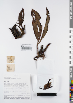
LE 01167586
Pholidota chinensis Lindl. det. Averyanov, Leonid Vladimirovich at 16.04.2000
Коллекторы: Averyanov, Leonid Vladimirovich; et al. Полевой номер образца: VH5248. Дата сбора: 16.04.2000. Административные регионы: VN - Kon Tum. Группы образцов: L. V. Averyanov specimens; L. V. Averyanov herbarium; Orchids of Vietnam, Laos and CambodiaТекст оригинальной этикетки:FLORA OF VIETNAM
Координаты: 14° 39′ N, 108° 25′ E ±1000 mСоздание записи: 2022-03-03, Galina Savich, PhotoScan D2. Статус обработки: work_status_1Цитирование: Образец LE 01167586 // Виртуальный гербарий Ботанического института им. В. Л. Комарова РАН — http://rr.herbariumle.ru/01167586Orchidaceae
Pholidota chinensis
S. Vietnam, Kontum Prov., Kon Plong Distr., Hieu Municipality, Mang La forest enterprise (14°39′N, 108°25′E). Primary evergreen broad-leaved wet forest with Dacrycarpus imbricatus on steep mt. slopes on sandstone & gneiss at elev. 1100-1200 m. Epiphyte on high mossy trees. Very common.
VH 5248 16.04.2000
International Botanical Expedition of the U.S.A. National Geographic Society (grant No 6383-98)
Collectors: L.Averyanov, P.K.Loc, P.H.Hoang, D.X.Du, N.T.Vinh
Pholidota chinensis
S. Vietnam, Kontum Prov., Kon Plong Distr., Hieu Municipality, Mang La forest enterprise (14°39′N, 108°25′E). Primary evergreen broad-leaved wet forest with Dacrycarpus imbricatus on steep mt. slopes on sandstone & gneiss at elev. 1100-1200 m. Epiphyte on high mossy trees. Very common.
VH 5248 16.04.2000
International Botanical Expedition of the U.S.A. National Geographic Society (grant No 6383-98)
Collectors: L.Averyanov, P.K.Loc, P.H.Hoang, D.X.Du, N.T.Vinh
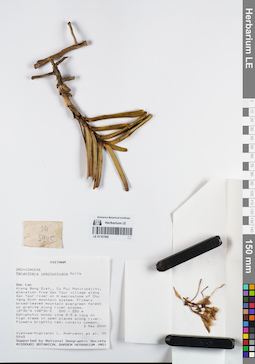
LE 01167585
Renanthera imschootiana Rolfe det. Averyanov, Leonid Vladimirovich at 03.05.2000
Коллекторы: Averyanov, Leonid Vladimirovich; et al. Полевой номер образца: VH5945. Дата сбора: 03.05.2000. Административные регионы: VN - Tinh GJak Lak. Группы образцов: L. V. Averyanov specimens; L. V. Averyanov herbarium; Orchids of Vietnam, Laos and CambodiaТекст оригинальной этикетки:FLORA OF VIETNAM
Координаты: 12° 30′ N, 108° 30′ E ±1000 mСоздание записи: 2022-03-03, Galina Savich, PhotoScan D2. Статус обработки: work_status_1Цитирование: Образец LE 01167585 // Виртуальный гербарий Ботанического института им. В. Л. Комарова РАН — http://rr.herbariumle.ru/01167585Orchidaceae
Renanthera imschootiana Rolfe ?
S. Vietnam, Dak Lac Prov., Krong Bong Distr., Cu Pui Municipality, elevation from Dak Tour village (12°30′N, 108°30′E) along Dak Tour river on N macroslope of Chu Yang Sinh mt system. Primary broad-leaved mountain evergreen forest on granites along river slopes at elev. 500-550 m. Epiphytic woody vine 2-3 m lg on high trees in open places along river. Flowers brightly red. Locally common.
VH 5945 03.05.2000
International Botanical Expedition of the U.S.A. National Geographic Society (grant No 6383-98)
Collectors: L.Averyanov, N.T.Hiep, N.Q.Hieu, P.H.Hoang, D.X.Du, N.T.Vinh
Renanthera imschootiana Rolfe ?
S. Vietnam, Dak Lac Prov., Krong Bong Distr., Cu Pui Municipality, elevation from Dak Tour village (12°30′N, 108°30′E) along Dak Tour river on N macroslope of Chu Yang Sinh mt system. Primary broad-leaved mountain evergreen forest on granites along river slopes at elev. 500-550 m. Epiphytic woody vine 2-3 m lg on high trees in open places along river. Flowers brightly red. Locally common.
VH 5945 03.05.2000
International Botanical Expedition of the U.S.A. National Geographic Society (grant No 6383-98)
Collectors: L.Averyanov, N.T.Hiep, N.Q.Hieu, P.H.Hoang, D.X.Du, N.T.Vinh
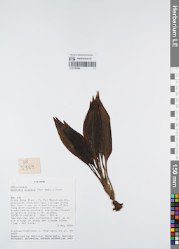
LE 01167584
Goodyera procera (Ker Gawl.) Hook. det. Averyanov, Leonid Vladimirovich at 03.05.2000
Коллекторы: Averyanov, Leonid Vladimirovich; et al. Полевой номер образца: VH5959. Дата сбора: 03.05.2000. Административные регионы: VN - Tinh GJak Lak. Группы образцов: L. V. Averyanov specimens; L. V. Averyanov herbarium; Orchids of Vietnam, Laos and CambodiaТекст оригинальной этикетки:FLORA OF VIETNAM
Координаты: 12° 30′ N, 108° 30′ E ±1000 mСоздание записи: 2022-03-03, Galina Savich, PhotoScan D2. Статус обработки: work_status_1Цитирование: Образец LE 01167584 // Виртуальный гербарий Ботанического института им. В. Л. Комарова РАН — http://rr.herbariumle.ru/01167584Orchidaceae
Goodyera procera
S. Vietnam, Dak Lac Prov., Krong Bong Distr., Cu Pui Municipality, elevation from Dak Tour village (12°30′N, 108°30′E) along Dak Tour river on N macroslope of Chu Yang Sinh mt system. Primary broad-leaved mountain evergreen forest on granites along river slopes at elev. 500-550 m. Terrestrial and lithophytic herb up to 0.4 m hg in shady wet places along river. Not rare.
VH 5959 03.05.2000
International Botanical Expedition of the U.S.A. National Geographic Society (grant No 6383-98)
Collectors: L.Averyanov, N.T.Hiep, N.Q.Hieu, P.H.Hoang, D.X.Du, N.T.Vinh
Goodyera procera
S. Vietnam, Dak Lac Prov., Krong Bong Distr., Cu Pui Municipality, elevation from Dak Tour village (12°30′N, 108°30′E) along Dak Tour river on N macroslope of Chu Yang Sinh mt system. Primary broad-leaved mountain evergreen forest on granites along river slopes at elev. 500-550 m. Terrestrial and lithophytic herb up to 0.4 m hg in shady wet places along river. Not rare.
VH 5959 03.05.2000
International Botanical Expedition of the U.S.A. National Geographic Society (grant No 6383-98)
Collectors: L.Averyanov, N.T.Hiep, N.Q.Hieu, P.H.Hoang, D.X.Du, N.T.Vinh
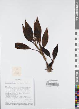
LE 01167583
Goodyera procera (Ker Gawl.) Hook. det. Averyanov, Leonid Vladimirovich at 12.05.2000
Коллекторы: Averyanov, Leonid Vladimirovich; et al. Полевой номер образца: VH6461. Дата сбора: 12.05.2000. Административные регионы: VN - Tinh GJak Lak. Группы образцов: L. V. Averyanov specimens; L. V. Averyanov herbarium; Orchids of Vietnam, Laos and CambodiaТекст оригинальной этикетки:FLORA OF VIETNAM
Координаты: 12° 30′ N, 108° 30′ E ±1000 mСоздание записи: 2022-03-03, Galina Savich, PhotoScan D2. Статус обработки: work_status_1Цитирование: Образец LE 01167583 // Виртуальный гербарий Ботанического института им. В. Л. Комарова РАН — http://rr.herbariumle.ru/01167583Orchidaceae
Goodyera procera
S. Vietnam, Dak Lac Prov., Krong Bong Distr., Cu Pui Municipality, elevation from Dak Tour village (12°30′N, 108°30′E) to main peak of Chu Yang Sinh mt system (12°24′N, 108°26′E) along Dak Tour river (N slope). Primary closed mountain broad-leaved evergreen forest on granite slopes along river canyon at elev. 700-800 m. Terrestrial rosette herb on wet sandy river slope. Common.
VH 6461 12.05.2000
International Botanical Expedition of the U.S.A. National Geographic Society (grant No 6383-98)
Collectors: L.Averyanov, N.T.Hiep, N.Q.Hieu, P.H.Hoang, D.X.Du, N.T.Vinh
Goodyera procera
S. Vietnam, Dak Lac Prov., Krong Bong Distr., Cu Pui Municipality, elevation from Dak Tour village (12°30′N, 108°30′E) to main peak of Chu Yang Sinh mt system (12°24′N, 108°26′E) along Dak Tour river (N slope). Primary closed mountain broad-leaved evergreen forest on granite slopes along river canyon at elev. 700-800 m. Terrestrial rosette herb on wet sandy river slope. Common.
VH 6461 12.05.2000
International Botanical Expedition of the U.S.A. National Geographic Society (grant No 6383-98)
Collectors: L.Averyanov, N.T.Hiep, N.Q.Hieu, P.H.Hoang, D.X.Du, N.T.Vinh
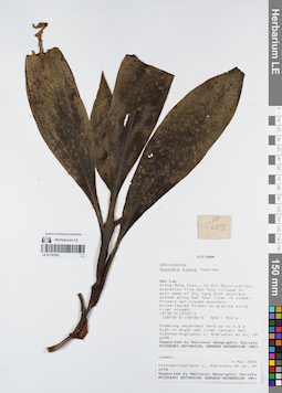
LE 01167582
Goodyera fumata Thwaites det. Averyanov, Leonid Vladimirovich at 04.05.2000
Коллекторы: Averyanov, Leonid Vladimirovich; et al. Полевой номер образца: VH6098. Дата сбора: 04.05.2000. Административные регионы: VN - Tinh GJak Lak. Группы образцов: L. V. Averyanov specimens; L. V. Averyanov herbarium; Orchids of Vietnam, Laos and CambodiaТекст оригинальной этикетки:FLORA OF VIETNAM
Координаты: 12° 30′ N, 108° 30′ E ±1000 mСоздание записи: 2022-03-03, Galina Savich, PhotoScan D2. Статус обработки: work_status_1Цитирование: Образец LE 01167582 // Виртуальный гербарий Ботанического института им. В. Л. Комарова РАН — http://rr.herbariumle.ru/01167582Orchidaceae
Goodyera fumata
S. Vietnam, Dak Lac Prov., Krong Bong Distr., Cu Pui Municipality, elevation from Dak Tour village (12°30′N, 108°30′E) to main peak of Chu Yang Sinh mt system (12°24′N, 108°26′E) along Dak Tour river (N slope). Primary wet closed mountain broad-leaved forest on granites along river slopes at elev. 500-900 m. Creeping ascendant herb up to 0.5 m hg in shady wet river canyon. Not common.
VH 6098 04.05.2000
International Botanical Expedition of the U.S.A. National Geographic Society (grant No 6383-98)
Collectors: L.Averyanov, N.T.Hiep, N.Q.Hieu, P.H.Hoang, D.X.Du, N.T.Vinh
Goodyera fumata
S. Vietnam, Dak Lac Prov., Krong Bong Distr., Cu Pui Municipality, elevation from Dak Tour village (12°30′N, 108°30′E) to main peak of Chu Yang Sinh mt system (12°24′N, 108°26′E) along Dak Tour river (N slope). Primary wet closed mountain broad-leaved forest on granites along river slopes at elev. 500-900 m. Creeping ascendant herb up to 0.5 m hg in shady wet river canyon. Not common.
VH 6098 04.05.2000
International Botanical Expedition of the U.S.A. National Geographic Society (grant No 6383-98)
Collectors: L.Averyanov, N.T.Hiep, N.Q.Hieu, P.H.Hoang, D.X.Du, N.T.Vinh
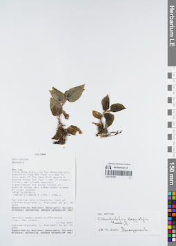
LE 01167581
Odontochilus brevistylis Hook.f. ⟮prelim. ID⟯ det. Averyanov, Leonid Vladimirovich at 28.02.2022
Коллекторы: Averyanov, Leonid Vladimirovich; et al. Полевой номер образца: VH6346. Дата сбора: 11.05.2000. Административные регионы: VN - Tinh GJak Lak. Группы образцов: L. V. Averyanov specimens; L. V. Averyanov herbarium; Orchids of Vietnam, Laos and CambodiaТекст оригинальной этикетки:FLORA OF VIETNAM
Координаты: 12° 30′ N, 108° 30′ E ±1000 mСоздание записи: 2022-03-03, Galina Savich, PhotoScan D2. Статус обработки: work_status_1Цитирование: Образец LE 01167581 // Виртуальный гербарий Ботанического института им. В. Л. Комарова РАН — http://rr.herbariumle.ru/01167581Orchidaceae
Goodyera sp.
S. Vietnam, Dak Lac Prov., Krong Bong Distr., Cu Pui Municipality, elevation from Dak Tour village (12°30′N, 108°30′E) to main peak of Chu Yang Sinh mt system (12°24′N, 108°26′E) along Dak Tour river (N slope). Primary wet closed mountain broad-leaved and mixed forest on granites along very steep shady slopes of river canyon at elev. 1700 m. Terrestrial and Lithophytic herb on vertical mossy shady cliffs along river. Not common.
VH 6346 11.05.2000
International Botanical Expedition of the U.S.A. National Geographic Society (grant No 6383-98)
Collectors: L.Averyanov, N.T.Hiep, N.Q.Hieu, P.H.Hoang, D.X.Du, N.T.Vinh
Goodyera sp.
S. Vietnam, Dak Lac Prov., Krong Bong Distr., Cu Pui Municipality, elevation from Dak Tour village (12°30′N, 108°30′E) to main peak of Chu Yang Sinh mt system (12°24′N, 108°26′E) along Dak Tour river (N slope). Primary wet closed mountain broad-leaved and mixed forest on granites along very steep shady slopes of river canyon at elev. 1700 m. Terrestrial and Lithophytic herb on vertical mossy shady cliffs along river. Not common.
VH 6346 11.05.2000
International Botanical Expedition of the U.S.A. National Geographic Society (grant No 6383-98)
Collectors: L.Averyanov, N.T.Hiep, N.Q.Hieu, P.H.Hoang, D.X.Du, N.T.Vinh
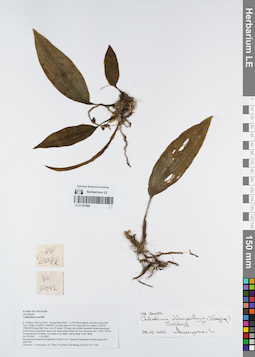
LE 01167580
Collabium chloranthum (Gagnep.) Seidenf. ⟮prelim. ID⟯ det. Averyanov, Leonid Vladimirovich at 28.02.2022
Коллекторы: Averyanov, Leonid Vladimirovich; et al. Полевой номер образца: VH6042. Дата сбора: 11.05.2000. Административные регионы: VN - Tinh GJak Lak. Группы образцов: L. V. Averyanov specimens; L. V. Averyanov herbarium; Orchids of Vietnam, Laos and CambodiaТекст оригинальной этикетки:FLORA OF VIETNAM
Координаты: 12° 30′ N, 108° 30′ E ±1000 mСоздание записи: 2022-03-03, Galina Savich, PhotoScan D2. Статус обработки: work_status_1Цитирование: Образец LE 01167580 // Виртуальный гербарий Ботанического института им. В. Л. Комарова РАН — http://rr.herbariumle.ru/01167580Orchidaceae
Mischobulbon aff.
S. Vietnam, Dak Lac Prov., Krong Bong Distr., Cu Pui Municipality, elevation from Dak Tour village (12°30′N, 108°30′E) to main peak of Chu Yang Sinh mt system (12°24′N, 108°26′E) along Dak Tour river (N slope). Primary wet closed mountain broad-leaved and mixed forest on granites along very steep shady slopes of river canyon at elev. 1500-1700 m. Terrestrial herb in shady very steep river slope. Leaves deep violet. Rare.
VH 6042 11.05.2000
International Botanical Expedition of the U.S.A. National Geographic Society (grant No 6383-98)
Collectors: L.Averyanov, N.T.Hiep, N.Q.Hieu, P.H.Hoang, D.X.Du, N.T.Vinh
Mischobulbon aff.
S. Vietnam, Dak Lac Prov., Krong Bong Distr., Cu Pui Municipality, elevation from Dak Tour village (12°30′N, 108°30′E) to main peak of Chu Yang Sinh mt system (12°24′N, 108°26′E) along Dak Tour river (N slope). Primary wet closed mountain broad-leaved and mixed forest on granites along very steep shady slopes of river canyon at elev. 1500-1700 m. Terrestrial herb in shady very steep river slope. Leaves deep violet. Rare.
VH 6042 11.05.2000
International Botanical Expedition of the U.S.A. National Geographic Society (grant No 6383-98)
Collectors: L.Averyanov, N.T.Hiep, N.Q.Hieu, P.H.Hoang, D.X.Du, N.T.Vinh
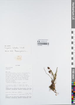
LE 01167579
Liparis luteola Lindl. det. Averyanov, Leonid Vladimirovich at 28.02.2022
Коллекторы: Averyanov, Leonid Vladimirovich; et al. Полевой номер образца: VH6245. Дата сбора: 07.05.2000. Административные регионы: VN - Tinh GJak Lak. Группы образцов: L. V. Averyanov specimens; L. V. Averyanov herbarium; Orchids of Vietnam, Laos and CambodiaТекст оригинальной этикетки:FLORA OF VIETNAM
Координаты: 12° 30′ N, 108° 30′ E ±1000 mСоздание записи: 2022-03-03, Galina Savich, PhotoScan D2. Статус обработки: work_status_1Цитирование: Образец LE 01167579 // Виртуальный гербарий Ботанического института им. В. Л. Комарова РАН — http://rr.herbariumle.ru/01167579Orchidaceae
Liparis sp.
S. Vietnam, Dak Lac Prov., Krong Bong Distr., Cu Pui Municipality, elevation from Dak Tour village (12°30′N, 108°30′E) to main peak of Chu Yang Sinh mt system (12°24′N, 108°26′E) along Dak Tour river (N slope). Primary closed wet broad-leaved and mixed forest (with Pinus, Fokienia, Dacrydium and Dacrycarpus) on steep granite slopes at elev. 1200-1300 m. Lithophytic herb in mossy wet open waterfall shelves. Common.
VH 6245 08.05.2000
International Botanical Expedition of the U.S.A. National Geographic Society (grant No 6383-98)
Collectors: L.Averyanov, N.T.Hiep, N.Q.Hieu, P.H.Hoang, D.X.Du, N.T.Vinh
Liparis sp.
S. Vietnam, Dak Lac Prov., Krong Bong Distr., Cu Pui Municipality, elevation from Dak Tour village (12°30′N, 108°30′E) to main peak of Chu Yang Sinh mt system (12°24′N, 108°26′E) along Dak Tour river (N slope). Primary closed wet broad-leaved and mixed forest (with Pinus, Fokienia, Dacrydium and Dacrycarpus) on steep granite slopes at elev. 1200-1300 m. Lithophytic herb in mossy wet open waterfall shelves. Common.
VH 6245 08.05.2000
International Botanical Expedition of the U.S.A. National Geographic Society (grant No 6383-98)
Collectors: L.Averyanov, N.T.Hiep, N.Q.Hieu, P.H.Hoang, D.X.Du, N.T.Vinh
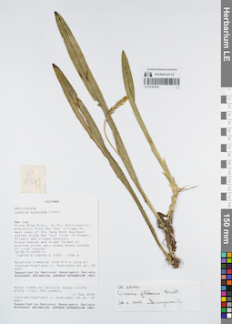
LE 01167578
Liparis gibbosa Finet det. Averyanov, Leonid Vladimirovich at 28.02.2022
Коллекторы: Averyanov, Leonid Vladimirovich; et al. Полевой номер образца: VH6347. Дата сбора: 11.05.2000. Административные регионы: VN - Tinh GJak Lak. Группы образцов: L. V. Averyanov specimens; L. V. Averyanov herbarium; Orchids of Vietnam, Laos and CambodiaТекст оригинальной этикетки:FLORA OF VIETNAM
Координаты: 12° 30′ N, 108° 30′ E ±1000 mСоздание записи: 2022-03-03, Galina Savich, PhotoScan D2. Статус обработки: work_status_1Цитирование: Образец LE 01167578 // Виртуальный гербарий Ботанического института им. В. Л. Комарова РАН — http://rr.herbariumle.ru/01167578Orchidaceae
Liparis disticha
S. Vietnam, Dak Lac Prov., Krong Bong Distr., Cu Pui Municipality, elevation from Dak Tour village (12°30′N, 108°30′E) to main peak of Chu Yang Sinh mt system (12°24′N, 108°26′E) along Dak Tour river (N slope). Primary wet closed mountain broad-leaved and mixed forest on granites along very steep shady slopes of river canyon at elev. 1700 m. Epiphyte creeping vine 3-4 m lg on mossy trees on vertical shady cliffs along river. Not common.
VH 6347 11.05.2000
International Botanical Expedition of the U.S.A. National Geographic Society (grant No 6383-98)
Collectors: L.Averyanov, N.T.Hiep, N.Q.Hieu, P.H.Hoang, D.X.Du, N.T.Vinh
Liparis disticha
S. Vietnam, Dak Lac Prov., Krong Bong Distr., Cu Pui Municipality, elevation from Dak Tour village (12°30′N, 108°30′E) to main peak of Chu Yang Sinh mt system (12°24′N, 108°26′E) along Dak Tour river (N slope). Primary wet closed mountain broad-leaved and mixed forest on granites along very steep shady slopes of river canyon at elev. 1700 m. Epiphyte creeping vine 3-4 m lg on mossy trees on vertical shady cliffs along river. Not common.
VH 6347 11.05.2000
International Botanical Expedition of the U.S.A. National Geographic Society (grant No 6383-98)
Collectors: L.Averyanov, N.T.Hiep, N.Q.Hieu, P.H.Hoang, D.X.Du, N.T.Vinh
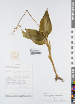
LE 01167577
Liparis sootenzanensis Fukuy. det. Averyanov, Leonid Vladimirovich at 28.02.2022
Коллекторы: Averyanov, Leonid Vladimirovich; et al. Полевой номер образца: VH6399. Дата сбора: 12.05.2000. Административные регионы: VN - Tinh GJak Lak. Группы образцов: L. V. Averyanov specimens; L. V. Averyanov herbarium; Orchids of Vietnam, Laos and CambodiaТекст оригинальной этикетки:FLORA OF VIETNAM
Координаты: 12° 30′ N, 108° 30′ E ±1000 mСоздание записи: 2022-03-03, Galina Savich, PhotoScan D2. Статус обработки: work_status_1Цитирование: Образец LE 01167577 // Виртуальный гербарий Ботанического института им. В. Л. Комарова РАН — http://rr.herbariumle.ru/01167577Orchidaceae
Liparis kontumensis Aver., sp. nov. = Liparis nigra var. flava Aver.
S. Vietnam, Dak Lac Prov., Krong Bong Distr., Cu Pui Municipality, elevation from Dak Tour village (12°30′N, 108°30′E) to main peak of Chu Yang Sinh mt system (12°24′N, 108°26′E) along Dak Tour river (N slope). Primary closed mountain broad-leaved evergreen forest on very steep granite slopes along river canyon at elev. 1300-1400 m. Terrestrial herb in rocky river valley. Flowers uniformly light yellow. Locally very common.
VH 6399 12.05.2000
International Botanical Expedition of the U.S.A. National Geographic Society (grant No 6383-98)
Collectors: L.Averyanov, N.T.Hiep, N.Q.Hieu, P.H.Hoang, D.X.Du, N.T.Vinh
Liparis kontumensis Aver., sp. nov. = Liparis nigra var. flava Aver.
S. Vietnam, Dak Lac Prov., Krong Bong Distr., Cu Pui Municipality, elevation from Dak Tour village (12°30′N, 108°30′E) to main peak of Chu Yang Sinh mt system (12°24′N, 108°26′E) along Dak Tour river (N slope). Primary closed mountain broad-leaved evergreen forest on very steep granite slopes along river canyon at elev. 1300-1400 m. Terrestrial herb in rocky river valley. Flowers uniformly light yellow. Locally very common.
VH 6399 12.05.2000
International Botanical Expedition of the U.S.A. National Geographic Society (grant No 6383-98)
Collectors: L.Averyanov, N.T.Hiep, N.Q.Hieu, P.H.Hoang, D.X.Du, N.T.Vinh
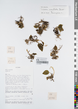
LE 01167576
Isotype of Liparis mamillata Aver. det. Averyanov, Leonid Vladimirovich at 28.02.2022
Коллекторы: Averyanov, Leonid Vladimirovich; et al. Полевой номер образца: VH6046. Дата сбора: 11.05.2000. Административные регионы: VN - Tinh GJak Lak. Группы образцов: L. V. Averyanov specimens; L. V. Averyanov herbarium; Orchids of Vietnam, Laos and CambodiaТекст оригинальной этикетки:FLORA OF VIETNAM
Orchidaceae
Liparis mammillata Aver., sp. nov. Type
S. Vietnam, Dak Lac Prov., Krong Bong Distr., Cu Pui Municipality, elevation from Dak Tour village (12°30′N, 108°30′E) to main peak of Chu Yang Sinh mt system (12°24′N, 108°26′E) along Dak Tour river (N slope). Primary wet closed mountain broad-leaved and mixed forest on granites along very steep shady slopes of river canyon at elev. 1500-1700 m. Lithophyte on wet shady waterfall mossy cliffs along river canyon. Tepals green, lip deep violet. Not common.
VH 6046 11.05.2000
International Botanical Expedition of the U.S.A. National Geographic Society (grant No 6383-98)
Collectors: L.Averyanov, N.T.Hiep, N.Q.Hieu, P.H.Hoang, D.X.Du, N.T.Vinh
Координаты: 12° 30′ N, 108° 30′ E ±1000 mСоздание записи: 2022-03-03, Galina Savich, PhotoScan D2. Статус обработки: work_status_1Цитирование: Образец LE 01167576 // Виртуальный гербарий Ботанического института им. В. Л. Комарова РАН — http://rr.herbariumle.ru/01167576Orchidaceae
Liparis mammillata Aver., sp. nov. Type
S. Vietnam, Dak Lac Prov., Krong Bong Distr., Cu Pui Municipality, elevation from Dak Tour village (12°30′N, 108°30′E) to main peak of Chu Yang Sinh mt system (12°24′N, 108°26′E) along Dak Tour river (N slope). Primary wet closed mountain broad-leaved and mixed forest on granites along very steep shady slopes of river canyon at elev. 1500-1700 m. Lithophyte on wet shady waterfall mossy cliffs along river canyon. Tepals green, lip deep violet. Not common.
VH 6046 11.05.2000
International Botanical Expedition of the U.S.A. National Geographic Society (grant No 6383-98)
Collectors: L.Averyanov, N.T.Hiep, N.Q.Hieu, P.H.Hoang, D.X.Du, N.T.Vinh
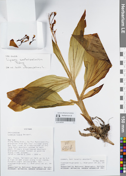
LE 01167575
Liparis sootenzanensis Fukuy. det. Averyanov, Leonid Vladimirovich at 28.02.2022
Коллекторы: Averyanov, Leonid Vladimirovich; et al. Полевой номер образца: VH6027. Дата сбора: 05.05.2000. Административные регионы: VN - Tinh GJak Lak. Группы образцов: L. V. Averyanov specimens; L. V. Averyanov herbarium; Orchids of Vietnam, Laos and CambodiaТекст оригинальной этикетки:FLORA OF VIETNAM
Координаты: 12° 30′ N, 108° 30′ E ±1000 mСоздание записи: 2022-03-03, Galina Savich, PhotoScan D2. Статус обработки: work_status_1Цитирование: Образец LE 01167575 // Виртуальный гербарий Ботанического института им. В. Л. Комарова РАН — http://rr.herbariumle.ru/01167575Orchidaceae
Liparis kontumensis Aver., sp. nov. = Liparis nigra var. flava Aver.
S. Vietnam, Dak Lac Prov., Krong Bong Distr., Cu Pui Municipality, elevation from Dak Tour village (12°30′N, 108°30′E) along Dak Tour river on N macroslope of Chu Yang Sinh mt system to main peak (12°24′N, 108°26′E). Primary broad-leaved mountain evergreen closed forest on granites along river slopes at elev. 1000-1200 m. Terrestrial herb up to 0.4 m hg in wet place along river rocks. Flowers light yellow-green. Not common, but locally abundant.
VH 6027 05-06.05.2000
International Botanical Expedition of the U.S.A. National Geographic Society (grant No 6383-98)
Collectors: L.Averyanov, N.T.Hiep, N.Q.Hieu, P.H.Hoang, D.X.Du, N.T.Vinh
Liparis kontumensis Aver., sp. nov. = Liparis nigra var. flava Aver.
S. Vietnam, Dak Lac Prov., Krong Bong Distr., Cu Pui Municipality, elevation from Dak Tour village (12°30′N, 108°30′E) along Dak Tour river on N macroslope of Chu Yang Sinh mt system to main peak (12°24′N, 108°26′E). Primary broad-leaved mountain evergreen closed forest on granites along river slopes at elev. 1000-1200 m. Terrestrial herb up to 0.4 m hg in wet place along river rocks. Flowers light yellow-green. Not common, but locally abundant.
VH 6027 05-06.05.2000
International Botanical Expedition of the U.S.A. National Geographic Society (grant No 6383-98)
Collectors: L.Averyanov, N.T.Hiep, N.Q.Hieu, P.H.Hoang, D.X.Du, N.T.Vinh
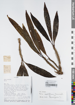
LE 01167574
Eria apertiflora Summerh. ⟮prelim. ID⟯ det. Averyanov, Leonid Vladimirovich at 28.02.2022
Коллекторы: Averyanov, Leonid Vladimirovich; et al. Полевой номер образца: VH6464. Дата сбора: 12.05.2000. Административные регионы: VN - Tinh GJak Lak. Группы образцов: L. V. Averyanov specimens; L. V. Averyanov herbarium; Orchids of Vietnam, Laos and CambodiaТекст оригинальной этикетки:FLORA OF VIETNAM
Координаты: 12° 30′ N, 108° 30′ E ±1000 mСоздание записи: 2022-03-03, Galina Savich, PhotoScan D2. Статус обработки: work_status_1Цитирование: Образец LE 01167574 // Виртуальный гербарий Ботанического института им. В. Л. Комарова РАН — http://rr.herbariumle.ru/01167574Orchidaceae
Eria sp.
S. Vietnam, Dak Lac Prov., Krong Bong Distr., Cu Pui Municipality, elevation from Dak Tour village (12°30′N, 108°30′E) to main peak of Chu Yang Sinh mt system (12°24′N, 108°26′E) along Dak Tour river (N slope). Primary closed mountain broad-leaved evergreen forest on granite slopes along river canyon at elev. 800 m. Lithophyte on mossy shady granite cliff along river. Not rare.
VH 6464 12.05.2000
International Botanical Expedition of the U.S.A. National Geographic Society (grant No 6383-98)
Collectors: L.Averyanov, N.T.Hiep, N.Q.Hieu, P.H.Hoang, D.X.Du, N.T.Vinh
Eria sp.
S. Vietnam, Dak Lac Prov., Krong Bong Distr., Cu Pui Municipality, elevation from Dak Tour village (12°30′N, 108°30′E) to main peak of Chu Yang Sinh mt system (12°24′N, 108°26′E) along Dak Tour river (N slope). Primary closed mountain broad-leaved evergreen forest on granite slopes along river canyon at elev. 800 m. Lithophyte on mossy shady granite cliff along river. Not rare.
VH 6464 12.05.2000
International Botanical Expedition of the U.S.A. National Geographic Society (grant No 6383-98)
Collectors: L.Averyanov, N.T.Hiep, N.Q.Hieu, P.H.Hoang, D.X.Du, N.T.Vinh
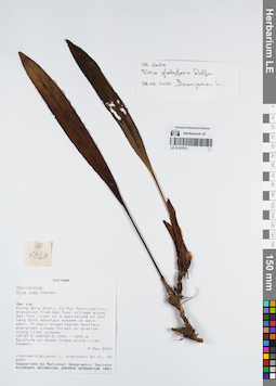
LE 01167573
Campanulorchis longipes (Gagnep.) J.Ponert det. Averyanov, Leonid Vladimirovich at 06.07.2022
Дополнительные определения: Eria globifera Rolfe det. Averyanov, Leonid Vladimirovich at 28.02.2022 Коллекторы: Averyanov, Leonid Vladimirovich; et al. Полевой номер образца: VH6020. Дата сбора: 05.05.2000. Административные регионы: VN - Tinh GJak Lak. Группы образцов: L. V. Averyanov specimens; L. V. Averyanov herbarium; Orchids of Vietnam, Laos and CambodiaТекст оригинальной этикетки:FLORA OF VIETNAM
Координаты: 12° 30′ N, 108° 30′ E ±1000 mСоздание записи: 2022-03-03, Galina Savich, PhotoScan D2. Статус обработки: work_status_1Цитирование: Образец LE 01167573 // Виртуальный гербарий Ботанического института им. В. Л. Комарова РАН — http://rr.herbariumle.ru/01167573Orchidaceae
Eria thao
S. Vietnam, Dak Lac Prov., Krong Bong Distr., Cu Pui Municipality, elevation from Dak Tour village (12°30′N, 108°30′E) along Dak Tour river on N macroslope of Chu Yang Sinh mt system to main peak (12°24′N, 108°26′E). Primary broad-leaved mountain evergreen closed forest on granites along river slopes at elev. 1000-1200 m. Epiphyte on mossy trees along river. Common.
VH 6020 05-06.05.2000
International Botanical Expedition of the U.S.A. National Geographic Society (grant No 6383-98)
Collectors: L.Averyanov, N.T.Hiep, N.Q.Hieu, P.H.Hoang, D.X.Du, N.T.Vinh
Eria thao
S. Vietnam, Dak Lac Prov., Krong Bong Distr., Cu Pui Municipality, elevation from Dak Tour village (12°30′N, 108°30′E) along Dak Tour river on N macroslope of Chu Yang Sinh mt system to main peak (12°24′N, 108°26′E). Primary broad-leaved mountain evergreen closed forest on granites along river slopes at elev. 1000-1200 m. Epiphyte on mossy trees along river. Common.
VH 6020 05-06.05.2000
International Botanical Expedition of the U.S.A. National Geographic Society (grant No 6383-98)
Collectors: L.Averyanov, N.T.Hiep, N.Q.Hieu, P.H.Hoang, D.X.Du, N.T.Vinh
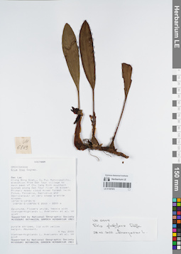
LE 01167572
Campanulorchis longipes (Gagnep.) J.Ponert det. Averyanov, Leonid Vladimirovich at 06.07.2022
Дополнительные определения: Eria globifera Rolfe det. Averyanov, Leonid Vladimirovich at 28.02.2022 Коллекторы: Averyanov, Leonid Vladimirovich; et al. Полевой номер образца: VH6149. Дата сбора: 09.05.2000. Административные регионы: VN - Tinh GJak Lak. Группы образцов: L. V. Averyanov specimens; L. V. Averyanov herbarium; Orchids of Vietnam, Laos and CambodiaТекст оригинальной этикетки:FLORA OF VIETNAM
Координаты: 12° 30′ N, 108° 30′ E ±1000 mСоздание записи: 2022-03-03, Galina Savich, PhotoScan D2. Статус обработки: work_status_1Цитирование: Образец LE 01167572 // Виртуальный гербарий Ботанического института им. В. Л. Комарова РАН — http://rr.herbariumle.ru/01167572Orchidaceae
Eria thao
S. Vietnam, Dak Lac Prov., Krong Bong Distr., Cu Pui Municipality, elevation from Dak Tour village (12°30′N, 108°30′E) to main peak of Chu Yang Sinh mt system (12°24′N, 108°26′E) along Dak Tour river (N slope). Primary mossy cloud mixed forest (with Pinus, Fokienia, Dacrydium and Dacrycarpus) on very steep granite slopes at elev. 2100-2200 m. Epiphyte. Flowers white, tepals with purple stripes, lip with yellow margin. Abundant.
VH 6149 09.05.2000
International Botanical Expedition of the U.S.A. National Geographic Society (grant No 6383-98)
Collectors: L.Averyanov, N.T.Hiep, N.Q.Hieu, P.H.Hoang, D.X.Du, N.T.Vinh
Eria thao
S. Vietnam, Dak Lac Prov., Krong Bong Distr., Cu Pui Municipality, elevation from Dak Tour village (12°30′N, 108°30′E) to main peak of Chu Yang Sinh mt system (12°24′N, 108°26′E) along Dak Tour river (N slope). Primary mossy cloud mixed forest (with Pinus, Fokienia, Dacrydium and Dacrycarpus) on very steep granite slopes at elev. 2100-2200 m. Epiphyte. Flowers white, tepals with purple stripes, lip with yellow margin. Abundant.
VH 6149 09.05.2000
International Botanical Expedition of the U.S.A. National Geographic Society (grant No 6383-98)
Collectors: L.Averyanov, N.T.Hiep, N.Q.Hieu, P.H.Hoang, D.X.Du, N.T.Vinh
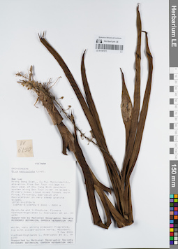
LE 01167571
Mycaranthes floribunda (D.Don) S.C.Chen & J.J.Wood det. Averyanov, Leonid Vladimirovich at 02.01.2025
Дополнительные определения: Eria paniculata Lindl. det. Averyanov, Leonid Vladimirovich at 09.05.2000 Коллекторы: Averyanov, Leonid Vladimirovich; et al. Полевой номер образца: VH6150. Дата сбора: 09.05.2000. Административные регионы: VN - Tinh GJak Lak. Группы образцов: L. V. Averyanov specimens; L. V. Averyanov herbarium; Orchids of Vietnam, Laos and CambodiaТекст оригинальной этикетки:FLORA OF VIETNAM
Координаты: 12° 30′ N, 108° 30′ E ±1000 mСоздание записи: 2022-03-03, Galina Savich, PhotoScan D2. Статус обработки: work_status_1Цитирование: Образец LE 01167571 // Виртуальный гербарий Ботанического института им. В. Л. Комарова РАН — http://rr.herbariumle.ru/01167571Orchidaceae
Eria paniculata
S. Vietnam, Dak Lac Prov., Krong Bong Distr., Cu Pui Municipality, elevation from Dak Tour village (12°30′N, 108°30′E) to main peak of Chu Yang Sinh mt system (12°24′N, 108°26′E) along Dak Tour river (N slope). Primary mossy cloud mixed forest (with Pinus, Fokienia, Dacrydium and Dacrycarpus) on very steep granite slopes at elev. 2100-2200 m. Epiphyte and lithophyte. Flowers white, very strong pleasant fragrant, lip with violet-purple marks. Abundant.
VH 6150 09.05.2000
International Botanical Expedition of the U.S.A. National Geographic Society (grant No 6383-98)
Collectors: L.Averyanov, N.T.Hiep, N.Q.Hieu, P.H.Hoang, D.X.Du, N.T.Vinh
Eria paniculata
S. Vietnam, Dak Lac Prov., Krong Bong Distr., Cu Pui Municipality, elevation from Dak Tour village (12°30′N, 108°30′E) to main peak of Chu Yang Sinh mt system (12°24′N, 108°26′E) along Dak Tour river (N slope). Primary mossy cloud mixed forest (with Pinus, Fokienia, Dacrydium and Dacrycarpus) on very steep granite slopes at elev. 2100-2200 m. Epiphyte and lithophyte. Flowers white, very strong pleasant fragrant, lip with violet-purple marks. Abundant.
VH 6150 09.05.2000
International Botanical Expedition of the U.S.A. National Geographic Society (grant No 6383-98)
Collectors: L.Averyanov, N.T.Hiep, N.Q.Hieu, P.H.Hoang, D.X.Du, N.T.Vinh
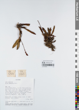
LE 01167570
Eria obscura Aver. det. Averyanov, Leonid Vladimirovich at 03.05.2000
Коллекторы: Averyanov, Leonid Vladimirovich; et al. Полевой номер образца: VH5968. Дата сбора: 03.05.2000. Административные регионы: VN - Tinh GJak Lak. Группы образцов: L. V. Averyanov specimens; L. V. Averyanov herbarium; Orchids of Vietnam, Laos and CambodiaТекст оригинальной этикетки:FLORA OF VIETNAM
Координаты: 12° 30′ N, 108° 30′ E ±1000 mСоздание записи: 2022-03-03, Galina Savich, PhotoScan D2. Статус обработки: work_status_1Цитирование: Образец LE 01167570 // Виртуальный гербарий Ботанического института им. В. Л. Комарова РАН — http://rr.herbariumle.ru/01167570Orchidaceae
Eria obscura Aver.
S. Vietnam, Dak Lac Prov., Krong Bong Distr., Cu Pui Municipality, elevation from Dak Tour village (12°30′N, 108°30′E) along Dak Tour river on N macroslope of Chu Yang Sinh mt system. Primary broad-leaved mountain evergreen forest on granites along river slopes at elev. 500-550 m. Epiphyte on trees along river in open places. Very common.
VH 5968 03.05.2000
International Botanical Expedition of the U.S.A. National Geographic Society (grant No 6383-98)
Collectors: L.Averyanov, N.T.Hiep, N.Q.Hieu, P.H.Hoang, D.X.Du, N.T.Vinh
Eria obscura Aver.
S. Vietnam, Dak Lac Prov., Krong Bong Distr., Cu Pui Municipality, elevation from Dak Tour village (12°30′N, 108°30′E) along Dak Tour river on N macroslope of Chu Yang Sinh mt system. Primary broad-leaved mountain evergreen forest on granites along river slopes at elev. 500-550 m. Epiphyte on trees along river in open places. Very common.
VH 5968 03.05.2000
International Botanical Expedition of the U.S.A. National Geographic Society (grant No 6383-98)
Collectors: L.Averyanov, N.T.Hiep, N.Q.Hieu, P.H.Hoang, D.X.Du, N.T.Vinh
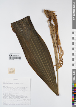
LE 01167569
Acanthophippium striatum Lindl. det. Averyanov, Leonid Vladimirovich at 06.05.2000
Коллекторы: Averyanov, Leonid Vladimirovich; et al. Полевой номер образца: VH6278. Дата сбора: 06.05.2000. Административные регионы: VN - Tinh GJak Lak. Группы образцов: L. V. Averyanov specimens; L. V. Averyanov herbarium; Orchids of Vietnam, Laos and CambodiaТекст оригинальной этикетки:FLORA OF VIETNAM
Координаты: 12° 30′ N, 108° 30′ E ±1000 mСоздание записи: 2022-03-03, Galina Savich, PhotoScan D2. Статус обработки: work_status_1Цитирование: Образец LE 01167569 // Виртуальный гербарий Ботанического института им. В. Л. Комарова РАН — http://rr.herbariumle.ru/01167569Orchidaceae
Acanthephippium striatum
S. Vietnam, Dak Lac Prov., Krong Bong Distr., Cu Pui Municipality, elevation from Dak Tour village (12°30′N, 108°30′E) to main peak of Chu Yang Sinh mt system (12°24′N, 108°26′E) along Dak Tour river (N slope). Primary closed wet broad-leaved forest on steep granite slopes at elev. 1200-1250 m. Terrestrial herb on steep shady river slope. Flowers yellowish, tepals with reddish stripes. Not rare.
VH 6278 06.05.2000
International Botanical Expedition of the U.S.A. National Geographic Society (grant No 6383-98)
Collectors: L.Averyanov, N.T.Hiep, N.Q.Hieu, P.H.Hoang, D.X.Du, N.T.Vinh
Acanthephippium striatum
S. Vietnam, Dak Lac Prov., Krong Bong Distr., Cu Pui Municipality, elevation from Dak Tour village (12°30′N, 108°30′E) to main peak of Chu Yang Sinh mt system (12°24′N, 108°26′E) along Dak Tour river (N slope). Primary closed wet broad-leaved forest on steep granite slopes at elev. 1200-1250 m. Terrestrial herb on steep shady river slope. Flowers yellowish, tepals with reddish stripes. Not rare.
VH 6278 06.05.2000
International Botanical Expedition of the U.S.A. National Geographic Society (grant No 6383-98)
Collectors: L.Averyanov, N.T.Hiep, N.Q.Hieu, P.H.Hoang, D.X.Du, N.T.Vinh
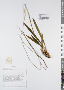
LE 01167568
Acriopsis liliifolia (J.Koenig) Ormerod det. Averyanov, Leonid Vladimirovich at 14.03.2022
Дополнительные определения: Acriopsis javanica Blume det. Averyanov, Leonid Vladimirovich at 03.05.2000 Коллекторы: Averyanov, Leonid Vladimirovich; et al. Полевой номер образца: VH5951. Дата сбора: 03.05.2000. Административные регионы: VN - Tinh GJak Lak. Группы образцов: L. V. Averyanov specimens; L. V. Averyanov herbarium; Orchids of Vietnam, Laos and CambodiaТекст оригинальной этикетки:FLORA OF VIETNAM
Координаты: 12° 30′ N, 108° 30′ E ±1000 mСоздание записи: 2022-03-03, Galina Savich, PhotoScan D2. Статус обработки: work_status_1Цитирование: Образец LE 01167568 // Виртуальный гербарий Ботанического института им. В. Л. Комарова РАН — http://rr.herbariumle.ru/01167568Orchidaceae
Acriopsis javanica
S. Vietnam, Dak Lac Prov., Krong Bong Distr., Cu Pui Municipality, elevation from Dak Tour village (12°30′N, 108°30′E) along Dak Tour river on N macroslope of Chu Yang Sinh mt system. Primary broad-leaved mountain evergreen forest on granites along river slopes at elev. 500-550 m. Epiphyte on high trees along river. Flowers: tepals whitish with dull purple stripe. Not rare.
VH 5951 03.05.2000
International Botanical Expedition of the U.S.A. National Geographic Society (grant No 6383-98)
Collectors: L.Averyanov, N.T.Hiep, N.Q.Hieu, P.H.Hoang, D.X.Du, N.T.Vinh
Acriopsis javanica
S. Vietnam, Dak Lac Prov., Krong Bong Distr., Cu Pui Municipality, elevation from Dak Tour village (12°30′N, 108°30′E) along Dak Tour river on N macroslope of Chu Yang Sinh mt system. Primary broad-leaved mountain evergreen forest on granites along river slopes at elev. 500-550 m. Epiphyte on high trees along river. Flowers: tepals whitish with dull purple stripe. Not rare.
VH 5951 03.05.2000
International Botanical Expedition of the U.S.A. National Geographic Society (grant No 6383-98)
Collectors: L.Averyanov, N.T.Hiep, N.Q.Hieu, P.H.Hoang, D.X.Du, N.T.Vinh
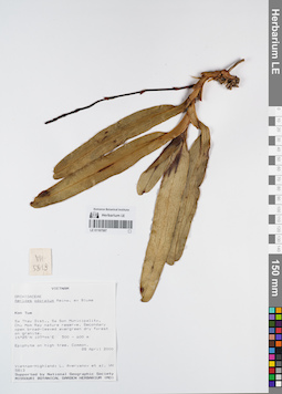
LE 01167567
Aerides odorata Lour. det. Averyanov, Leonid Vladimirovich at 28.04.2000
Коллекторы: Averyanov, Leonid Vladimirovich; et al. Полевой номер образца: VH5813. Дата сбора: 28.04.2000. Административные регионы: VN - Kon Tum. Группы образцов: L. V. Averyanov specimens; L. V. Averyanov herbarium; Orchids of Vietnam, Laos and CambodiaТекст оригинальной этикетки:FLORA OF VIETNAM
Координаты: 14° 25′ N, 107° 44′ E ±1000 mСоздание записи: 2022-03-03, Galina Savich, PhotoScan D2. Статус обработки: work_status_1Цитирование: Образец LE 01167567 // Виртуальный гербарий Ботанического института им. В. Л. Комарова РАН — http://rr.herbariumle.ru/01167567Orchidaceae
Aerides odorata
S. Vietnam, Kontum Prov., Sa Thay Distr., Sa Son Municipality, Chu Mom Ray nature reserve (14°25′N, 107°44′E). Secondary open broad-leaved evergreen dry forest on granites at elev. 500-600 m. Epiphyte on high tree. Common.
VH 5813 28 04.2000
International Botanical Expedition of the U.S.A. National Geographic Society (grant No 6383-98)
Collectors: L.Averyanov, P.K.Loc, P.H.Hoang, D.X.Du, N.T.Vinh
Aerides odorata
S. Vietnam, Kontum Prov., Sa Thay Distr., Sa Son Municipality, Chu Mom Ray nature reserve (14°25′N, 107°44′E). Secondary open broad-leaved evergreen dry forest on granites at elev. 500-600 m. Epiphyte on high tree. Common.
VH 5813 28 04.2000
International Botanical Expedition of the U.S.A. National Geographic Society (grant No 6383-98)
Collectors: L.Averyanov, P.K.Loc, P.H.Hoang, D.X.Du, N.T.Vinh
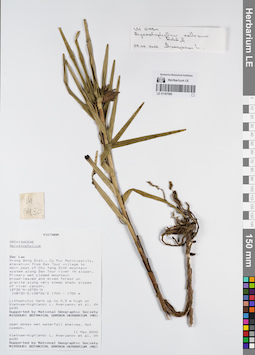
LE 01167566
Agrostophyllum callosum Rchb.f. det. Averyanov, Leonid Vladimirovich at 24.02.2022
Коллекторы: Averyanov, Leonid Vladimirovich; et al. Полевой номер образца: VH6430. Дата сбора: 11.05.2000. Административные регионы: VN - Tinh GJak Lak. Группы образцов: L. V. Averyanov specimens; L. V. Averyanov herbarium; Orchids of Vietnam, Laos and CambodiaТекст оригинальной этикетки:FLORA OF VIETNAM
Координаты: 12° 30′ N, 108° 30′ E ±1000 mСоздание записи: 2022-03-03, Galina Savich, PhotoScan D2. Статус обработки: work_status_1Цитирование: Образец LE 01167566 // Виртуальный гербарий Ботанического института им. В. Л. Комарова РАН — http://rr.herbariumle.ru/01167566Orchidaceae
Agrostophyllum sp.
S. Vietnam, Dak Lac Prov., Krong Bong Distr., Cu Pui Municipality, elevation from Dak Tour village (12°30′N, 108°30′E) to main peak of Chu Yang Sinh mt system (12°24′N, 108°26′E) along Dak Tour river (N slope). Primary wet closed mountain broad-leaved and mixed forest on granites along very steep shady slopes of river at elev. 1700 m. Lithophytic herb up to 0.5 m hg on open mossy wet waterfall shelves. Not common.
VH 6430 11.05.2000
International Botanical Expedition of the U.S.A. National Geographic Society (grant No 6383-98)
Collectors: L.Averyanov, N.T.Hiep, N.Q.Hieu, P.H.Hoang, D.X.Du, N.T.Vinh
Agrostophyllum sp.
S. Vietnam, Dak Lac Prov., Krong Bong Distr., Cu Pui Municipality, elevation from Dak Tour village (12°30′N, 108°30′E) to main peak of Chu Yang Sinh mt system (12°24′N, 108°26′E) along Dak Tour river (N slope). Primary wet closed mountain broad-leaved and mixed forest on granites along very steep shady slopes of river at elev. 1700 m. Lithophytic herb up to 0.5 m hg on open mossy wet waterfall shelves. Not common.
VH 6430 11.05.2000
International Botanical Expedition of the U.S.A. National Geographic Society (grant No 6383-98)
Collectors: L.Averyanov, N.T.Hiep, N.Q.Hieu, P.H.Hoang, D.X.Du, N.T.Vinh
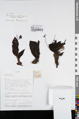
LE 01167565
Amitostigma bidupense (Aver.) Aver. det. Averyanov, Leonid Vladimirovich at 24.02.2022
Коллекторы: Averyanov, Leonid Vladimirovich; et al. Полевой номер образца: VH6159. Дата сбора: 09.05.2000. Административные регионы: VN - Tinh GJak Lak. Группы образцов: L. V. Averyanov specimens; L. V. Averyanov herbarium; Orchids of Vietnam, Laos and CambodiaТекст оригинальной этикетки:FLORA OF VIETNAM
Координаты: 12° 30′ N, 108° 30′ E ±1000 mСоздание записи: 2022-03-03, Galina Savich, PhotoScan D2. Статус обработки: work_status_1Цитирование: Образец LE 01167565 // Виртуальный гербарий Ботанического института им. В. Л. Комарова РАН — http://rr.herbariumle.ru/01167565Orchidaceae
Amitostigma bidupense Aver.
S. Vietnam, Dak Lac Prov., Krong Bong Distr., Cu Pui Municipality, elevation from Dak Tour village (12°30′N, 108°30′E) to main peak of Chu Yang Sinh mt system (12°24′N, 108°26′E) along Dak Tour river (N slope). Primary mossy cloud mixed forest (with Pinus, Fokienia, Dacrydium and Dacrycarpus) on very steep granite slopes at elev. 2000-2200 m. Lithophyte on vertical mossy cliffs. Flowers pink-purple. Very common at elev. 2000-2400 m.
VH 6159 09.05.2000
International Botanical Expedition of the U.S.A. National Geographic Society (grant No 6383-98)
Collectors: L.Averyanov, N.T.Hiep, N.Q.Hieu, P.H.Hoang, D.X.Du, N.T.Vinh
Amitostigma bidupense Aver.
S. Vietnam, Dak Lac Prov., Krong Bong Distr., Cu Pui Municipality, elevation from Dak Tour village (12°30′N, 108°30′E) to main peak of Chu Yang Sinh mt system (12°24′N, 108°26′E) along Dak Tour river (N slope). Primary mossy cloud mixed forest (with Pinus, Fokienia, Dacrydium and Dacrycarpus) on very steep granite slopes at elev. 2000-2200 m. Lithophyte on vertical mossy cliffs. Flowers pink-purple. Very common at elev. 2000-2400 m.
VH 6159 09.05.2000
International Botanical Expedition of the U.S.A. National Geographic Society (grant No 6383-98)
Collectors: L.Averyanov, N.T.Hiep, N.Q.Hieu, P.H.Hoang, D.X.Du, N.T.Vinh
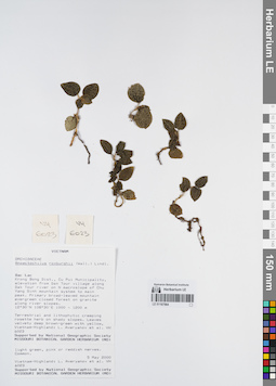
LE 01167564
Anoectochilus roxburghii (Wall.) Lindl. det. Averyanov, Leonid Vladimirovich at 05.05.2000
Коллекторы: Averyanov, Leonid Vladimirovich; et al. Полевой номер образца: VH6023. Дата сбора: 05.05.2000. Административные регионы: VN - Tinh GJak Lak. Группы образцов: L. V. Averyanov specimens; L. V. Averyanov herbarium; Orchids of Vietnam, Laos and CambodiaТекст оригинальной этикетки:FLORA OF VIETNAM
Координаты: 12° 30′ N, 108° 30′ E ±1000 mСоздание записи: 2022-03-03, Galina Savich, PhotoScan D2. Статус обработки: work_status_1Цитирование: Образец LE 01167564 // Виртуальный гербарий Ботанического института им. В. Л. Комарова РАН — http://rr.herbariumle.ru/01167564Orchidaceae
Anoectochilus roxburghii
S. Vietnam, Dak Lac Prov., Krong Bong Distr., Cu Pui Municipality, elevation from Dak Tour village (12°30′N, 108°30′E) along Dak Tour river on N macroslope of Chu Yang Sinh mt system to main peak (12°24′N, 108°26′E). Primary broad-leaved mountain evergreen closed forest on granites along river slopes at elev. 1000-1200 m. Terrestrial and lithophytic creeping rosette herb on shady slopes. Leaves velvety deep brown-green with yellow, light green, pink or reddish nerves. Common.
VH 6023 05-06.05.2000
International Botanical Expedition of the U.S.A. National Geographic Society (grant No 6383-98)
Collectors: L.Averyanov, N.T.Hiep, N.Q.Hieu, P.H.Hoang, D.X.Du, N.T.Vinh
Anoectochilus roxburghii
S. Vietnam, Dak Lac Prov., Krong Bong Distr., Cu Pui Municipality, elevation from Dak Tour village (12°30′N, 108°30′E) along Dak Tour river on N macroslope of Chu Yang Sinh mt system to main peak (12°24′N, 108°26′E). Primary broad-leaved mountain evergreen closed forest on granites along river slopes at elev. 1000-1200 m. Terrestrial and lithophytic creeping rosette herb on shady slopes. Leaves velvety deep brown-green with yellow, light green, pink or reddish nerves. Common.
VH 6023 05-06.05.2000
International Botanical Expedition of the U.S.A. National Geographic Society (grant No 6383-98)
Collectors: L.Averyanov, N.T.Hiep, N.Q.Hieu, P.H.Hoang, D.X.Du, N.T.Vinh
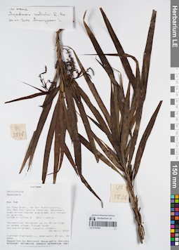
LE 01167563
Apostasia wallichii R.Br. det. Averyanov, Leonid Vladimirovich at 24.02.2022
Коллекторы: Averyanov, Leonid Vladimirovich; et al. Полевой номер образца: VH5806. Дата сбора: 28.04.2000. Административные регионы: VN - Kon Tum. Группы образцов: L. V. Averyanov specimens; L. V. Averyanov herbarium; Orchids of Vietnam, Laos and CambodiaТекст оригинальной этикетки:FLORA OF VIETNAM
Координаты: 14° 25′ N, 107° 44′ E ±1000 mСоздание записи: 2022-03-03, Galina Savich, PhotoScan D2. Статус обработки: work_status_1Цитирование: Образец LE 01167563 // Виртуальный гербарий Ботанического института им. В. Л. Комарова РАН — http://rr.herbariumle.ru/01167563Orchidaceae
Apostasia sp.
S. Vietnam, Kontum Prov., Sa Thay Distr., Sa Son Municipality, Chu Mom Ray nature reserve (14°25′N, 107°44′E). Secondary open broad-leaved evergreen dry forest on granites at elev. 500-600 m. Terrestrial shrublet up to 30 cm hg on steep slope. Flower buds yellowish-green. Locally common.
VH 5806 28 04.2000
International Botanical Expedition of the U.S.A. National Geographic Society (grant No 6383-98)
Collectors: L.Averyanov, P.K.Loc, P.H.Hoang, D.X.Du, N.T.Vinh
Apostasia sp.
S. Vietnam, Kontum Prov., Sa Thay Distr., Sa Son Municipality, Chu Mom Ray nature reserve (14°25′N, 107°44′E). Secondary open broad-leaved evergreen dry forest on granites at elev. 500-600 m. Terrestrial shrublet up to 30 cm hg on steep slope. Flower buds yellowish-green. Locally common.
VH 5806 28 04.2000
International Botanical Expedition of the U.S.A. National Geographic Society (grant No 6383-98)
Collectors: L.Averyanov, P.K.Loc, P.H.Hoang, D.X.Du, N.T.Vinh
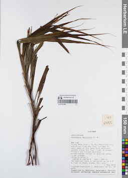
LE 01167562
Apostasia wallichii R.Br. det. Averyanov, Leonid Vladimirovich at 04.05.2000
Коллекторы: Averyanov, Leonid Vladimirovich; et al. Полевой номер образца: VH6095. Дата сбора: 04.05.2000. Административные регионы: VN - Tinh GJak Lak. Группы образцов: L. V. Averyanov specimens; L. V. Averyanov herbarium; Orchids of Vietnam, Laos and CambodiaТекст оригинальной этикетки:FLORA OF VIETNAM
Координаты: 12° 30′ N, 108° 30′ E ±1000 mСоздание записи: 2022-03-03, Galina Savich, PhotoScan D2. Статус обработки: work_status_1Цитирование: Образец LE 01167562 // Виртуальный гербарий Ботанического института им. В. Л. Комарова РАН — http://rr.herbariumle.ru/01167562Orchidaceae
Apostasia wallichii ?
S. Vietnam, Dak Lac Prov., Krong Bong Distr., Cu Pui Municipality, elevation from Dak Tour village (12°30′N, 108°30′E) to main peak of Chu Yang Sinh mt system (12°24′N, 108°26′E) along Dak Tour river (N slope). Primary wet closed mountain broad-leaved forest on granites along river slopes at elev. 500-900 m. Terrestrial herb or shrublet up to 0.5 m hg in shady place. Not rare.
VH 6095 04.05.2000
International Botanical Expedition of the U.S.A. National Geographic Society (grant No 6383-98)
Collectors: L.Averyanov, N.T.Hiep, N.Q.Hieu, P.H.Hoang, D.X.Du, N.T.Vinh
Apostasia wallichii ?
S. Vietnam, Dak Lac Prov., Krong Bong Distr., Cu Pui Municipality, elevation from Dak Tour village (12°30′N, 108°30′E) to main peak of Chu Yang Sinh mt system (12°24′N, 108°26′E) along Dak Tour river (N slope). Primary wet closed mountain broad-leaved forest on granites along river slopes at elev. 500-900 m. Terrestrial herb or shrublet up to 0.5 m hg in shady place. Not rare.
VH 6095 04.05.2000
International Botanical Expedition of the U.S.A. National Geographic Society (grant No 6383-98)
Collectors: L.Averyanov, N.T.Hiep, N.Q.Hieu, P.H.Hoang, D.X.Du, N.T.Vinh
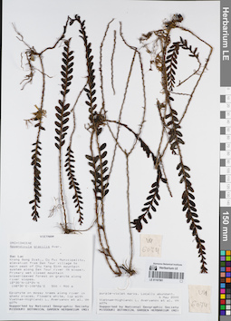
LE 01167561
Appendicula gracilis Aver. det. Averyanov, Leonid Vladimirovich at 04.05.2000
Коллекторы: Averyanov, Leonid Vladimirovich; et al. Полевой номер образца: VH6074. Дата сбора: 04.05.2000. Административные регионы: VN - Tinh GJak Lak. Группы образцов: L. V. Averyanov specimens; L. V. Averyanov herbarium; Orchids of Vietnam, Laos and CambodiaТекст оригинальной этикетки:FLORA OF VIETNAM
Координаты: 12° 30′ N, 108° 30′ E ±1000 mСоздание записи: 2022-03-03, Galina Savich, PhotoScan D2. Статус обработки: work_status_1Цитирование: Образец LE 01167561 // Виртуальный гербарий Ботанического института им. В. Л. Комарова РАН — http://rr.herbariumle.ru/01167561Orchidaceae
Appendicula gracilis Aver.
S. Vietnam, Dak Lac Prov., Krong Bong Distr., Cu Pui Municipality, elevation from Dak Tour village (12°30′N, 108°30′E) to main peak of Chu Yang Sinh mt system (12°24′N, 108°26′E) along Dak Tour river (N slope). Primary wet closed mountain broad-leaved forest on granites along river slopes at elev. 500-900 m. Epiphyte on mossy trees along river in shady places. Flowers white, lip with purple-violet marks. Locally abundant.
VH 6074 04.05.2000
International Botanical Expedition of the U.S.A. National Geographic Society (grant No 6383-98)
Collectors: L.Averyanov, N.T.Hiep, N.Q.Hieu, P.H.Hoang, D.X.Du, N.T.Vinh
Appendicula gracilis Aver.
S. Vietnam, Dak Lac Prov., Krong Bong Distr., Cu Pui Municipality, elevation from Dak Tour village (12°30′N, 108°30′E) to main peak of Chu Yang Sinh mt system (12°24′N, 108°26′E) along Dak Tour river (N slope). Primary wet closed mountain broad-leaved forest on granites along river slopes at elev. 500-900 m. Epiphyte on mossy trees along river in shady places. Flowers white, lip with purple-violet marks. Locally abundant.
VH 6074 04.05.2000
International Botanical Expedition of the U.S.A. National Geographic Society (grant No 6383-98)
Collectors: L.Averyanov, N.T.Hiep, N.Q.Hieu, P.H.Hoang, D.X.Du, N.T.Vinh
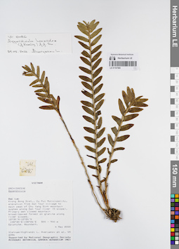
LE 01167560
Appendicula hexandra (J.Koenig) J.J.Sm. det. Averyanov, Leonid Vladimirovich at 24.02.2022
Коллекторы: Averyanov, Leonid Vladimirovich; et al. Полевой номер образца: VH6086. Дата сбора: 04.05.2000. Административные регионы: VN - Tinh GJak Lak. Группы образцов: L. V. Averyanov specimens; L. V. Averyanov herbarium; Orchids of Vietnam, Laos and CambodiaТекст оригинальной этикетки:FLORA OF VIETNAM
Координаты: 12° 30′ N, 108° 30′ E ±1000 mСоздание записи: 2022-03-03, Galina Savich, PhotoScan D2. Статус обработки: work_status_1Цитирование: Образец LE 01167560 // Виртуальный гербарий Ботанического института им. В. Л. Комарова РАН — http://rr.herbariumle.ru/01167560Orchidaceae
Appendicula sp.
S. Vietnam, Dak Lac Prov., Krong Bong Distr., Cu Pui Municipality, elevation from Dak Tour village (12°30′N, 108°30′E) to main peak of Chu Yang Sinh mt system (12°24′N, 108°26′E) along Dak Tour river (N slope). Primary wet closed mountain broad-leaved forest on granites along river slopes at elev. 500-900 m. Epiphyte. Abundant.
VH 6086 04.05.2000
International Botanical Expedition of the U.S.A. National Geographic Society (grant No 6383-98)
Collectors: L.Averyanov, N.T.Hiep, N.Q.Hieu, P.H.Hoang, D.X.Du, N.T.Vinh
Appendicula sp.
S. Vietnam, Dak Lac Prov., Krong Bong Distr., Cu Pui Municipality, elevation from Dak Tour village (12°30′N, 108°30′E) to main peak of Chu Yang Sinh mt system (12°24′N, 108°26′E) along Dak Tour river (N slope). Primary wet closed mountain broad-leaved forest on granites along river slopes at elev. 500-900 m. Epiphyte. Abundant.
VH 6086 04.05.2000
International Botanical Expedition of the U.S.A. National Geographic Society (grant No 6383-98)
Collectors: L.Averyanov, N.T.Hiep, N.Q.Hieu, P.H.Hoang, D.X.Du, N.T.Vinh
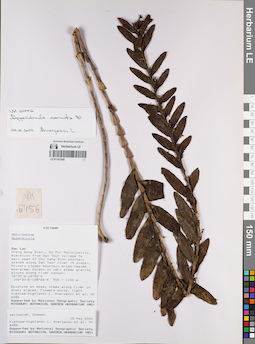
LE 01167559
Appendicula cornuta Blume det. Averyanov, Leonid Vladimirovich at 24.02.2022
Коллекторы: Averyanov, Leonid Vladimirovich; et al. Полевой номер образца: VH6456. Дата сбора: 12.05.2000. Административные регионы: VN - Tinh GJak Lak. Группы образцов: L. V. Averyanov specimens; L. V. Averyanov herbarium; Orchids of Vietnam, Laos and CambodiaТекст оригинальной этикетки:FLORA OF VIETNAM
Координаты: 12° 30′ N, 108° 30′ E ±1000 mСоздание записи: 2022-03-03, Galina Savich, PhotoScan D2. Статус обработки: work_status_1Цитирование: Образец LE 01167559 // Виртуальный гербарий Ботанического института им. В. Л. Комарова РАН — http://rr.herbariumle.ru/01167559Orchidaceae
Appendicula hexandra (Koen.) J.J.Smith
S. Vietnam, Dak Lac Prov., Krong Bong Distr., Cu Pui Municipality, elevation from Dak Tour village (12°30′N, 108°30′E) to main peak of Chu Yang Sinh mt system (12°24′N, 108°26′E) along Dak Tour river (N slope). Primary closed mountain broad-leaved evergreen forest on granite slopes along river canyon at elev. 1000 m. Epiphyte on mossy trees along river in shady places. Flowers white, light yellowish. Common.
VH 6456 12.05.2000
International Botanical Expedition of the U.S.A. National Geographic Society (grant No 6383-98)
Collectors: L.Averyanov, N.T.Hiep, N.Q.Hieu, P.H.Hoang, D.X.Du, N.T.Vinh
Appendicula hexandra (Koen.) J.J.Smith
S. Vietnam, Dak Lac Prov., Krong Bong Distr., Cu Pui Municipality, elevation from Dak Tour village (12°30′N, 108°30′E) to main peak of Chu Yang Sinh mt system (12°24′N, 108°26′E) along Dak Tour river (N slope). Primary closed mountain broad-leaved evergreen forest on granite slopes along river canyon at elev. 1000 m. Epiphyte on mossy trees along river in shady places. Flowers white, light yellowish. Common.
VH 6456 12.05.2000
International Botanical Expedition of the U.S.A. National Geographic Society (grant No 6383-98)
Collectors: L.Averyanov, N.T.Hiep, N.Q.Hieu, P.H.Hoang, D.X.Du, N.T.Vinh
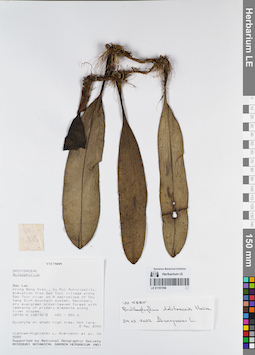
LE 01167558
Bulbophyllum delitescens Hance det. Averyanov, Leonid Vladimirovich at 24.02.2022
Коллекторы: Averyanov, Leonid Vladimirovich; et al. Полевой номер образца: VH5885. Дата сбора: 02.05.2000. Административные регионы: VN - Tinh GJak Lak. Группы образцов: L. V. Averyanov specimens; L. V. Averyanov herbarium; Orchids of Vietnam, Laos and CambodiaТекст оригинальной этикетки:FLORA OF VIETNAM
Координаты: 12° 30′ N, 108° 30′ E ±1000 mСоздание записи: 2022-03-03, Galina Savich, PhotoScan D2. Статус обработки: work_status_1Цитирование: Образец LE 01167558 // Виртуальный гербарий Ботанического института им. В. Л. Комарова РАН — http://rr.herbariumle.ru/01167558Orchidaceae
Bulbophyllum hiepii aff.
S. Vietnam, Dak Lac Prov., Krong Bong Distr., Cu Pui Municipality, elevation from Dak Tour village (12°30′N, 108°30′E) along Dak Tour river on N macroslope of Chu Yang Sinh mt system. Secondary dry evergreen broad-leaved forest with remnants of primary elements along river slopes at elev. 450-550 m. Epiphyte on shady high tree. Not rare.
VH 5885 02.05.2000
International Botanical Expedition of the U.S.A. National Geographic Society (grant No 6383-98)
Collectors: L.Averyanov, N.T.Hiep, N.Q.Hieu, P.H.Hoang, D.X.Du, N.T.Vinh
Bulbophyllum hiepii aff.
S. Vietnam, Dak Lac Prov., Krong Bong Distr., Cu Pui Municipality, elevation from Dak Tour village (12°30′N, 108°30′E) along Dak Tour river on N macroslope of Chu Yang Sinh mt system. Secondary dry evergreen broad-leaved forest with remnants of primary elements along river slopes at elev. 450-550 m. Epiphyte on shady high tree. Not rare.
VH 5885 02.05.2000
International Botanical Expedition of the U.S.A. National Geographic Society (grant No 6383-98)
Collectors: L.Averyanov, N.T.Hiep, N.Q.Hieu, P.H.Hoang, D.X.Du, N.T.Vinh
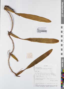
LE 01167557
Bulbophyllum orientale Seidenf. det. Averyanov, Leonid Vladimirovich at 28.04.2000
Коллекторы: Averyanov, Leonid Vladimirovich; et al. Полевой номер образца: VH5805. Дата сбора: 28.04.2000. Административные регионы: VN - Kon Tum. Группы образцов: L. V. Averyanov specimens; L. V. Averyanov herbarium; Orchids of Vietnam, Laos and CambodiaТекст оригинальной этикетки:FLORA OF VIETNAM
Координаты: 14° 25′ N, 107° 44′ E ±1000 mСоздание записи: 2022-03-03, Galina Savich, PhotoScan D2. Статус обработки: work_status_1Цитирование: Образец LE 01167557 // Виртуальный гербарий Ботанического института им. В. Л. Комарова РАН — http://rr.herbariumle.ru/01167557Orchidaceae
Bulbophyllum orientale ?
S. Vietnam, Kontum Prov., Sa Thay Distr., Sa Son Municipality, Chu Mom Ray nature reserve (14°25′N, 107°44′E). Secondary open broad-leaved evergreen dry forest on granites at elev. 500-600 m. Creeping epiphyte in shady place along stream. Common.
VH 5805 28 04.2000
International Botanical Expedition of the U.S.A. National Geographic Society (grant No 6383-98)
Collectors: L.Averyanov, P.K.Loc, P.H.Hoang, D.X.Du, N.T.Vinh
Bulbophyllum orientale ?
S. Vietnam, Kontum Prov., Sa Thay Distr., Sa Son Municipality, Chu Mom Ray nature reserve (14°25′N, 107°44′E). Secondary open broad-leaved evergreen dry forest on granites at elev. 500-600 m. Creeping epiphyte in shady place along stream. Common.
VH 5805 28 04.2000
International Botanical Expedition of the U.S.A. National Geographic Society (grant No 6383-98)
Collectors: L.Averyanov, P.K.Loc, P.H.Hoang, D.X.Du, N.T.Vinh
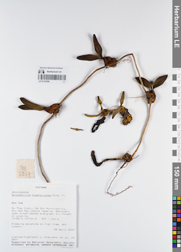
LE 01167556
Bulbophyllum blepharistes Rchb.f. det. Averyanov, Leonid Vladimirovich at 28.04.2000
Коллекторы: Averyanov, Leonid Vladimirovich; et al. Полевой номер образца: VH5807. Дата сбора: 28.04.2000. Административные регионы: VN - Kon Tum. Группы образцов: L. V. Averyanov specimens; L. V. Averyanov herbarium; Orchids of Vietnam, Laos and CambodiaТекст оригинальной этикетки:FLORA OF VIETNAM
Координаты: 14° 25′ N, 107° 44′ E ±1000 mСоздание записи: 2022-03-03, Galina Savich, PhotoScan D2. Статус обработки: work_status_1Цитирование: Образец LE 01167556 // Виртуальный гербарий Ботанического института им. В. Л. Комарова РАН — http://rr.herbariumle.ru/01167556Orchidaceae
Bulbophyllum blepharistes
S. Vietnam, Kontum Prov., Sa Thay Distr., Sa Son Municipality, Chu Mom Ray nature reserve (14°25′N, 107°44′E). Secondary open broad-leaved evergreen dry forest on granites at elev. 500-600 m. Creeping epiphyte on high tree. Not common.
VH 5807 28 04.2000
International Botanical Expedition of the U.S.A. National Geographic Society (grant No 6383-98)
Collectors: L.Averyanov, P.K.Loc, P.H.Hoang, D.X.Du, N.T.Vinh
Bulbophyllum blepharistes
S. Vietnam, Kontum Prov., Sa Thay Distr., Sa Son Municipality, Chu Mom Ray nature reserve (14°25′N, 107°44′E). Secondary open broad-leaved evergreen dry forest on granites at elev. 500-600 m. Creeping epiphyte on high tree. Not common.
VH 5807 28 04.2000
International Botanical Expedition of the U.S.A. National Geographic Society (grant No 6383-98)
Collectors: L.Averyanov, P.K.Loc, P.H.Hoang, D.X.Du, N.T.Vinh
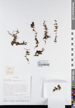
LE 01167555
Bulbophyllum hymenanthum Hook.f. det. Averyanov, Leonid Vladimirovich at 07.05.2000
Коллекторы: Averyanov, Leonid Vladimirovich; et al. Полевой номер образца: VH6251. Дата сбора: 07.05.2000. Административные регионы: VN - Tinh GJak Lak. Группы образцов: L. V. Averyanov specimens; L. V. Averyanov herbarium; Orchids of Vietnam, Laos and CambodiaТекст оригинальной этикетки:FLORA OF VIETNAM
Координаты: 12° 30′ N, 108° 30′ E ±1000 mСоздание записи: 2022-03-03, Galina Savich, PhotoScan D2. Статус обработки: work_status_1Цитирование: Образец LE 01167555 // Виртуальный гербарий Ботанического института им. В. Л. Комарова РАН — http://rr.herbariumle.ru/01167555Orchidaceae
Bulbophyllum hymenanthum
S. Vietnam, Dak Lac Prov., Krong Bong Distr., Cu Pui Municipality, elevation from Dak Tour village (12°30′N, 108°30′E) to main peak of Chu Yang Sinh mt system (12°24′N, 108°26′E) along Dak Tour river (N slope). Primary closed wet broad-leaved and mixed forest (with Pinus, Fokienia, Dacrydium and Dacrycarpus) on steep granite slopes at elev. 1200-1550 m. Epiphyte on high trees. Rare.
Bulbophyllum hymenanthum
S. Vietnam, Dak Lac Prov., Krong Bong Distr., Cu Pui Municipality, elevation from Dak Tour village (12°30′N, 108°30′E) to main peak of Chu Yang Sinh mt system (12°24′N, 108°26′E) along Dak Tour river (N slope). Primary closed wet broad-leaved and mixed forest (with Pinus, Fokienia, Dacrydium and Dacrycarpus) on steep granite slopes at elev. 1200-1550 m. Epiphyte on high trees. Rare.
VH 6251 07.05.2000
International Botanical Expedition of the U.S.A. National Geographic Society (grant No 6383-98)
Collectors: L.Averyanov, N.T.Hiep, N.Q.Hieu, P.H.Hoang, D.X.Du, N.T.Vinh
International Botanical Expedition of the U.S.A. National Geographic Society (grant No 6383-98)
Collectors: L.Averyanov, N.T.Hiep, N.Q.Hieu, P.H.Hoang, D.X.Du, N.T.Vinh
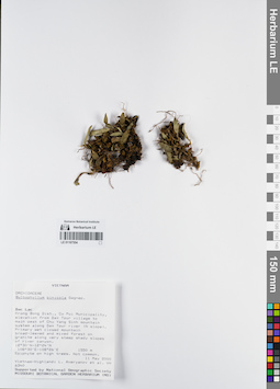
LE 01167554
Bulbophyllum pinicolum Gagnep. det. Averyanov, Leonid Vladimirovich at 11.05.2000
Коллекторы: Averyanov, Leonid Vladimirovich; et al. Полевой номер образца: VH6340. Дата сбора: 11.05.2000. Административные регионы: VN - Tinh GJak Lak. Группы образцов: L. V. Averyanov specimens; L. V. Averyanov herbarium; Orchids of Vietnam, Laos and CambodiaТекст оригинальной этикетки:FLORA OF VIETNAM
Координаты: 12° 30′ N, 108° 30′ E ±1000 mСоздание записи: 2022-03-03, Galina Savich, PhotoScan D2. Статус обработки: work_status_1Цитирование: Образец LE 01167554 // Виртуальный гербарий Ботанического института им. В. Л. Комарова РАН — http://rr.herbariumle.ru/01167554Orchidaceae
Bulbophyllum pinicolum
S. Vietnam, Dak Lac Prov., Krong Bong Distr., Cu Pui Municipality, elevation from Dak Tour village (12°30′N, 108°30′E) to main peak of Chu Yang Sinh mt system (12°24′N, 108°26′E) along Dak Tour river (N slope). Primary wet closed mountain broad-leaved and mixed forest on granites along very steep shady slopes of river canyon at elev. 1550 m. Epiphyte on high trees. Not common.
VH 6340 11.05.2000
International Botanical Expedition of the U.S.A. National Geographic Society (grant No 6383-98)
Collectors: L.Averyanov, N.T.Hiep, N.Q.Hieu, P.H.Hoang, D.X.Du, N.T.Vinh
Bulbophyllum pinicolum
S. Vietnam, Dak Lac Prov., Krong Bong Distr., Cu Pui Municipality, elevation from Dak Tour village (12°30′N, 108°30′E) to main peak of Chu Yang Sinh mt system (12°24′N, 108°26′E) along Dak Tour river (N slope). Primary wet closed mountain broad-leaved and mixed forest on granites along very steep shady slopes of river canyon at elev. 1550 m. Epiphyte on high trees. Not common.
VH 6340 11.05.2000
International Botanical Expedition of the U.S.A. National Geographic Society (grant No 6383-98)
Collectors: L.Averyanov, N.T.Hiep, N.Q.Hieu, P.H.Hoang, D.X.Du, N.T.Vinh
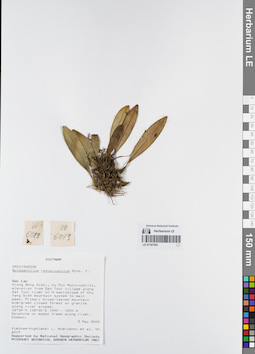
LE 01167553
Bulbophyllum retusiusculum Rchb.f. det. Averyanov, Leonid Vladimirovich at 05.05.2000
Коллекторы: Averyanov, Leonid Vladimirovich; et al. Полевой номер образца: VH6019. Дата сбора: 05.05.2000. Административные регионы: VN - Tinh GJak Lak. Группы образцов: L. V. Averyanov specimens; L. V. Averyanov herbarium; Orchids of Vietnam, Laos and CambodiaТекст оригинальной этикетки:FLORA OF VIETNAM
Координаты: 12° 30′ N, 108° 30′ E ±1000 mСоздание записи: 2022-03-03, Galina Savich, PhotoScan D2. Статус обработки: work_status_1Цитирование: Образец LE 01167553 // Виртуальный гербарий Ботанического института им. В. Л. Комарова РАН — http://rr.herbariumle.ru/01167553Orchidaceae
Bulbophyllum retusiusculum
S. Vietnam, Dak Lac Prov., Krong Bong Distr., Cu Pui Municipality, elevation from Dak Tour village (12°30′N, 108°30′E) along Dak Tour river on N macroslope of Chu Yang Sinh mt system to main peak (12°24′N, 108°26′E). Primary broad-leaved mountain evergreen closed forest on granites along river slopes at elev. 1000-1200 m. Epiphyte on mossy trees along river. Common.
VH 6019 05-06.05.2000
International Botanical Expedition of the U.S.A. National Geographic Society (grant No 6383-98)
Collectors: L.Averyanov, N.T.Hiep, N.Q.Hieu, P.H.Hoang, D.X.Du, N.T.Vinh
Bulbophyllum retusiusculum
S. Vietnam, Dak Lac Prov., Krong Bong Distr., Cu Pui Municipality, elevation from Dak Tour village (12°30′N, 108°30′E) along Dak Tour river on N macroslope of Chu Yang Sinh mt system to main peak (12°24′N, 108°26′E). Primary broad-leaved mountain evergreen closed forest on granites along river slopes at elev. 1000-1200 m. Epiphyte on mossy trees along river. Common.
VH 6019 05-06.05.2000
International Botanical Expedition of the U.S.A. National Geographic Society (grant No 6383-98)
Collectors: L.Averyanov, N.T.Hiep, N.Q.Hieu, P.H.Hoang, D.X.Du, N.T.Vinh
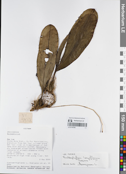
LE 01167552
Bulbophyllum longiflorum Thouars ⟮prelim. ID⟯ det. Averyanov, Leonid Vladimirovich at 28.02.2022
Коллекторы: Averyanov, Leonid Vladimirovich; et al. Полевой номер образца: VH5932. Дата сбора: 02.05.2000. Административные регионы: VN - Tinh GJak Lak. Группы образцов: L. V. Averyanov specimens; L. V. Averyanov herbarium; Orchids of Vietnam, Laos and CambodiaТекст оригинальной этикетки:FLORA OF VIETNAM
Координаты: 12° 30′ N, 108° 30′ E ±1000 mСоздание записи: 2022-03-03, Galina Savich, PhotoScan D2. Статус обработки: work_status_1Цитирование: Образец LE 01167552 // Виртуальный гербарий Ботанического института им. В. Л. Комарова РАН — http://rr.herbariumle.ru/01167552Orchidaceae
Bulbophyllum sp.
S. Vietnam, Dak Lac Prov., Krong Bong Distr., Cu Pui Municipality, elevation from Dak Tour village (12°30′N, 108°30′E) along Dak Tour river on N macroslope of Chu Yang Sinh mt system. Secondary dry evergreen broad-leaved forest with remnants of primary elements along river slopes at elev. 450-550 m. Epiphyte on high tree along river. Not rare.
Bulbophyllum sp.
S. Vietnam, Dak Lac Prov., Krong Bong Distr., Cu Pui Municipality, elevation from Dak Tour village (12°30′N, 108°30′E) along Dak Tour river on N macroslope of Chu Yang Sinh mt system. Secondary dry evergreen broad-leaved forest with remnants of primary elements along river slopes at elev. 450-550 m. Epiphyte on high tree along river. Not rare.
VH 5932 02.05.2000
International Botanical Expedition of the U.S.A. National Geographic Society (grant No 6383-98)
Collectors: L.Averyanov, N.T.Hiep, N.Q.Hieu, P.H.Hoang, D.X.Du, N.T.Vinh
International Botanical Expedition of the U.S.A. National Geographic Society (grant No 6383-98)
Collectors: L.Averyanov, N.T.Hiep, N.Q.Hieu, P.H.Hoang, D.X.Du, N.T.Vinh
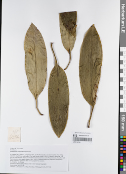
LE 01167551
Bulbophyllum clipeibulbum J.J.Verm. det. Averyanov, Leonid Vladimirovich at 07.05.2000
Коллекторы: Averyanov, Leonid Vladimirovich; et al. Полевой номер образца: VH6256. Дата сбора: 07.05.2000. Административные регионы: VN - Tinh GJak Lak. Группы образцов: L. V. Averyanov specimens; L. V. Averyanov herbarium; Orchids of Vietnam, Laos and CambodiaТекст оригинальной этикетки:FLORA OF VIETNAM
Координаты: 12° 30′ N, 108° 30′ E ±1000 mСоздание записи: 2022-03-03, Galina Savich, PhotoScan D2. Статус обработки: work_status_1Цитирование: Образец LE 01167551 // Виртуальный гербарий Ботанического института им. В. Л. Комарова РАН — http://rr.herbariumle.ru/01167551Orchidaceae
Bulbophyllum clipeibulbum Vermeulen
S. Vietnam, Dak Lac Prov., Krong Bong Distr., Cu Pui Municipality, elevation from Dak Tour village (12°30′N, 108°30′E) to main peak of Chu Yang Sinh mt system (12°24′N, 108°26′E) along Dak Tour river (N slope). Primary closed wet broad-leaved and mixed forest (with Pinus, Fokienia, Dacrydium and Dacrycarpus) on steep granite slopes at elev. 1450 m. Creeping epiphyte on high trees. Inflorescence fleshy up to 0.6 m lg. Flowers dirty brown-purplish. Not common.
VH 6256 07.05.2000
International Botanical Expedition of the U.S.A. National Geographic Society (grant No 6383-98)
Collectors: L.Averyanov, N.T.Hiep, N.Q.Hieu, P.H.Hoang, D.X.Du, N.T.Vinh
Bulbophyllum clipeibulbum Vermeulen
S. Vietnam, Dak Lac Prov., Krong Bong Distr., Cu Pui Municipality, elevation from Dak Tour village (12°30′N, 108°30′E) to main peak of Chu Yang Sinh mt system (12°24′N, 108°26′E) along Dak Tour river (N slope). Primary closed wet broad-leaved and mixed forest (with Pinus, Fokienia, Dacrydium and Dacrycarpus) on steep granite slopes at elev. 1450 m. Creeping epiphyte on high trees. Inflorescence fleshy up to 0.6 m lg. Flowers dirty brown-purplish. Not common.
VH 6256 07.05.2000
International Botanical Expedition of the U.S.A. National Geographic Society (grant No 6383-98)
Collectors: L.Averyanov, N.T.Hiep, N.Q.Hieu, P.H.Hoang, D.X.Du, N.T.Vinh
LE 01167550
Bulbophyllum clipeibulbum J.J.Verm. det. Averyanov, Leonid Vladimirovich at 07.05.2000
Коллекторы: Averyanov, Leonid Vladimirovich; et al. Полевой номер образца: VH6256. Дата сбора: 07.05.2000. Административные регионы: VN - Tinh GJak Lak. Группы образцов: L. V. Averyanov specimens; L. V. Averyanov herbarium; Orchids of Vietnam, Laos and CambodiaТекст оригинальной этикетки:FLORA OF VIETNAM
Координаты: 12° 30′ N, 108° 30′ E ±1000 mСоздание записи: 2022-03-03, Galina Savich, PhotoScan D2. Статус обработки: work_status_1Цитирование: Образец LE 01167550 // Виртуальный гербарий Ботанического института им. В. Л. Комарова РАН — http://rr.herbariumle.ru/01167550Orchidaceae
Bulbophyllum clipeibulbum Vermeulen
S. Vietnam, Dak Lac Prov., Krong Bong Distr., Cu Pui Municipality, elevation from Dak Tour village (12°30′N, 108°30′E) to main peak of Chu Yang Sinh mt system (12°24′N, 108°26′E) along Dak Tour river (N slope). Primary closed wet broad-leaved and mixed forest (with Pinus, Fokienia, Dacrydium and Dacrycarpus) on steep granite slopes at elev. 1450 m. Creeping epiphyte on high trees. Inflorescence fleshy up to 0.6 m lg. Flowers dirty brown-purplish. Not common.
VH 6256 07.05.2000
International Botanical Expedition of the U.S.A. National Geographic Society (grant No 6383-98)
Collectors: L.Averyanov, N.T.Hiep, N.Q.Hieu, P.H.Hoang, D.X.Du, N.T.Vinh
Bulbophyllum clipeibulbum Vermeulen
S. Vietnam, Dak Lac Prov., Krong Bong Distr., Cu Pui Municipality, elevation from Dak Tour village (12°30′N, 108°30′E) to main peak of Chu Yang Sinh mt system (12°24′N, 108°26′E) along Dak Tour river (N slope). Primary closed wet broad-leaved and mixed forest (with Pinus, Fokienia, Dacrydium and Dacrycarpus) on steep granite slopes at elev. 1450 m. Creeping epiphyte on high trees. Inflorescence fleshy up to 0.6 m lg. Flowers dirty brown-purplish. Not common.
VH 6256 07.05.2000
International Botanical Expedition of the U.S.A. National Geographic Society (grant No 6383-98)
Collectors: L.Averyanov, N.T.Hiep, N.Q.Hieu, P.H.Hoang, D.X.Du, N.T.Vinh
LE 01167549
Bulbophyllum astelidum Aver. ⟮prelim. ID⟯ det. Averyanov, Leonid Vladimirovich at 07.05.2000
Коллекторы: Averyanov, Leonid Vladimirovich; et al. Полевой номер образца: VH6258. Дата сбора: 07.05.2000. Административные регионы: VN - Tinh GJak Lak. Группы образцов: L. V. Averyanov specimens; L. V. Averyanov herbarium; Orchids of Vietnam, Laos and CambodiaТекст оригинальной этикетки:FLORA OF VIETNAM
Координаты: 12° 30′ N, 108° 30′ E ±1000 mСоздание записи: 2022-03-03, Galina Savich, PhotoScan D2. Статус обработки: work_status_1Цитирование: Образец LE 01167549 // Виртуальный гербарий Ботанического института им. В. Л. Комарова РАН — http://rr.herbariumle.ru/01167549Orchidaceae
Bulbophyllum astelidum ?
S. Vietnam, Dak Lac Prov., Krong Bong Distr., Cu Pui Municipality, elevation from Dak Tour village (12°30′N, 108°30′E) to main peak of Chu Yang Sinh mt system (12°24′N, 108°26′E) along Dak Tour river (N slope). Primary closed wet broad-leaved and mixed forest (with Pinus, Fokienia, Dacrydium and Dacrycarpus) on steep granite slopes at elev. 1450 m. Epiphyte on high trees. Very common.
VH 6258 07.05.2000
International Botanical Expedition of the U.S.A. National Geographic Society (grant No 6383-98)
Collectors: L.Averyanov, N.T.Hiep, N.Q.Hieu, P.H.Hoang, D.X.Du, N.T.Vinh
Bulbophyllum astelidum ?
S. Vietnam, Dak Lac Prov., Krong Bong Distr., Cu Pui Municipality, elevation from Dak Tour village (12°30′N, 108°30′E) to main peak of Chu Yang Sinh mt system (12°24′N, 108°26′E) along Dak Tour river (N slope). Primary closed wet broad-leaved and mixed forest (with Pinus, Fokienia, Dacrydium and Dacrycarpus) on steep granite slopes at elev. 1450 m. Epiphyte on high trees. Very common.
VH 6258 07.05.2000
International Botanical Expedition of the U.S.A. National Geographic Society (grant No 6383-98)
Collectors: L.Averyanov, N.T.Hiep, N.Q.Hieu, P.H.Hoang, D.X.Du, N.T.Vinh
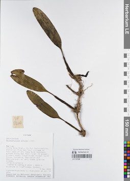
LE 01167548
Bulbophyllum affine Lindl. det. Averyanov, Leonid Vladimirovich at 09.05.2000
Коллекторы: Averyanov, Leonid Vladimirovich; et al. Полевой номер образца: VH6206. Дата сбора: 09.05.2000. Административные регионы: VN - Tinh GJak Lak. Группы образцов: L. V. Averyanov specimens; L. V. Averyanov herbarium; Orchids of Vietnam, Laos and CambodiaТекст оригинальной этикетки:FLORA OF VIETNAM
Координаты: 12° 30′ N, 108° 30′ E ±1000 mСоздание записи: 2022-03-03, Galina Savich, PhotoScan D2. Статус обработки: work_status_1Цитирование: Образец LE 01167548 // Виртуальный гербарий Ботанического института им. В. Л. Комарова РАН — http://rr.herbariumle.ru/01167548Orchidaceae
Bulbophyllum affine ?
S. Vietnam, Dak Lac Prov., Krong Bong Distr., Cu Pui Municipality, elevation from Dak Tour village (12°30′N, 108°30′E) to main peak of Chu Yang Sinh mt system (12°24′N, 108°26′E) along Dak Tour river (N slope). Primary mossy cloud mixed forest (with Pinus, Fokienia, Dacrydium and Dacrycarpus) on very steep granite slopes at elev. 2000-2200 m. Epiphyte on high trees. Common.
VH 6206 09.05.2000
International Botanical Expedition of the U.S.A. National Geographic Society (grant No 6383-98)
Collectors: L.Averyanov, N.T.Hiep, N.Q.Hieu, P.H.Hoang, D.X.Du, N.T.Vinh
Bulbophyllum affine ?
S. Vietnam, Dak Lac Prov., Krong Bong Distr., Cu Pui Municipality, elevation from Dak Tour village (12°30′N, 108°30′E) to main peak of Chu Yang Sinh mt system (12°24′N, 108°26′E) along Dak Tour river (N slope). Primary mossy cloud mixed forest (with Pinus, Fokienia, Dacrydium and Dacrycarpus) on very steep granite slopes at elev. 2000-2200 m. Epiphyte on high trees. Common.
VH 6206 09.05.2000
International Botanical Expedition of the U.S.A. National Geographic Society (grant No 6383-98)
Collectors: L.Averyanov, N.T.Hiep, N.Q.Hieu, P.H.Hoang, D.X.Du, N.T.Vinh
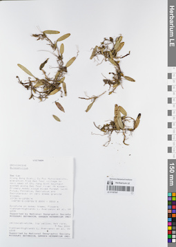
LE 01167547
Bulbophyllum astelidum Aver. ⟮prelim. ID⟯ det. Averyanov, Leonid Vladimirovich at 09.05.2000
Коллекторы: Averyanov, Leonid Vladimirovich; et al. Полевой номер образца: VH6208. Дата сбора: 09.05.2000. Административные регионы: VN - Tinh GJak Lak. Группы образцов: L. V. Averyanov specimens; L. V. Averyanov herbarium; Orchids of Vietnam, Laos and CambodiaТекст оригинальной этикетки:FLORA OF VIETNAM
Координаты: 12° 30′ N, 108° 30′ E ±1000 mСоздание записи: 2022-03-03, Galina Savich, PhotoScan D2. Статус обработки: work_status_1Цитирование: Образец LE 01167547 // Виртуальный гербарий Ботанического института им. В. Л. Комарова РАН — http://rr.herbariumle.ru/01167547Orchidaceae
Bulbophyllum astelidum Aver.
S. Vietnam, Dak Lac Prov., Krong Bong Distr., Cu Pui Municipality, elevation from Dak Tour village (12°30′N, 108°30′E) to main peak of Chu Yang Sinh mt system (12°24′N, 108°26′E) along Dak Tour river (N slope). Primary mossy cloud mixed forest (with Pinus, Fokienia, Dacrydium and Dacrycarpus) on very steep granite slopes at elev. 2000-2200 m. Epiphyte on mossy trees. Flowers yellowish-white, lip yellow. Not rare.
VH 6208 09.05.2000
International Botanical Expedition of the U.S.A. National Geographic Society (grant No 6383-98)
Collectors: L.Averyanov, N.T.Hiep, N.Q.Hieu, P.H.Hoang, D.X.Du, N.T.Vinh
Bulbophyllum astelidum Aver.
S. Vietnam, Dak Lac Prov., Krong Bong Distr., Cu Pui Municipality, elevation from Dak Tour village (12°30′N, 108°30′E) to main peak of Chu Yang Sinh mt system (12°24′N, 108°26′E) along Dak Tour river (N slope). Primary mossy cloud mixed forest (with Pinus, Fokienia, Dacrydium and Dacrycarpus) on very steep granite slopes at elev. 2000-2200 m. Epiphyte on mossy trees. Flowers yellowish-white, lip yellow. Not rare.
VH 6208 09.05.2000
International Botanical Expedition of the U.S.A. National Geographic Society (grant No 6383-98)
Collectors: L.Averyanov, N.T.Hiep, N.Q.Hieu, P.H.Hoang, D.X.Du, N.T.Vinh
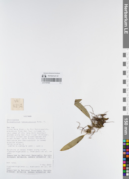
LE 01167546
Bulbophyllum retusiusculum Rchb.f. det. Averyanov, Leonid Vladimirovich at 07.05.2000
Коллекторы: Averyanov, Leonid Vladimirovich; et al. Полевой номер образца: VH6237. Дата сбора: 07.05.2000. Административные регионы: VN - Tinh GJak Lak. Группы образцов: L. V. Averyanov specimens; L. V. Averyanov herbarium; Orchids of Vietnam, Laos and CambodiaТекст оригинальной этикетки:FLORA OF VIETNAM
Координаты: 12° 30′ N, 108° 30′ E ±1000 mСоздание записи: 2022-03-03, Galina Savich, PhotoScan D2. Статус обработки: work_status_1Цитирование: Образец LE 01167546 // Виртуальный гербарий Ботанического института им. В. Л. Комарова РАН — http://rr.herbariumle.ru/01167546Orchidaceae
Bulbophyllum retusiusculum Rchb.f.
S. Vietnam, Dak Lac Prov., Krong Bong Distr., Cu Pui Municipality, elevation from Dak Tour village (12°30′N, 108°30′E) to main peak of Chu Yang Sinh mt system (12°24′N, 108°26′E) along Dak Tour river (N slope). Primary closed wet broad-leaved and mixed forest (with Pinus, Fokienia, Dacrydium and Dacrycarpus) on steep granite slopes at elev. 1200-1300 m. Epiphyte on mossy trees along river. Not rare.
VH 6237 08.05.2000
International Botanical Expedition of the U.S.A. National Geographic Society (grant No 6383-98)
Collectors: L.Averyanov, N.T.Hiep, N.Q.Hieu, P.H.Hoang, D.X.Du, N.T.Vinh
Bulbophyllum retusiusculum Rchb.f.
S. Vietnam, Dak Lac Prov., Krong Bong Distr., Cu Pui Municipality, elevation from Dak Tour village (12°30′N, 108°30′E) to main peak of Chu Yang Sinh mt system (12°24′N, 108°26′E) along Dak Tour river (N slope). Primary closed wet broad-leaved and mixed forest (with Pinus, Fokienia, Dacrydium and Dacrycarpus) on steep granite slopes at elev. 1200-1300 m. Epiphyte on mossy trees along river. Not rare.
VH 6237 08.05.2000
International Botanical Expedition of the U.S.A. National Geographic Society (grant No 6383-98)
Collectors: L.Averyanov, N.T.Hiep, N.Q.Hieu, P.H.Hoang, D.X.Du, N.T.Vinh
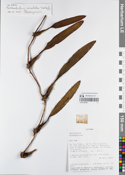
LE 01167545
Bulbophyllum orientale Seidenf. det. Averyanov, Leonid Vladimirovich at 28.02.2022
Коллекторы: Averyanov, Leonid Vladimirovich; et al. Полевой номер образца: VH5802. Дата сбора: 28.04.2000. Административные регионы: VN - Kon Tum. Группы образцов: L. V. Averyanov specimens; L. V. Averyanov herbarium; Orchids of Vietnam, Laos and CambodiaТекст оригинальной этикетки:FLORA OF VIETNAM
Координаты: 14° 25′ N, 107° 44′ E ±1000 mСоздание записи: 2022-03-03, Galina Savich, PhotoScan D2. Статус обработки: work_status_1Цитирование: Образец LE 01167545 // Виртуальный гербарий Ботанического института им. В. Л. Комарова РАН — http://rr.herbariumle.ru/01167545Orchidaceae
Bulbophyllum sp.
S. Vietnam, Kontum Prov., Sa Thay Distr., Sa Son Municipality, Chu Mom Ray nature reserve (14°25′N, 107°44′E). Secondary open broad-leaved evergreen dry forest on granites at elev. 500-600 m. Creeping epiphyte on high tree along stream. Not rare.
VH 5802 28 04.2000
International Botanical Expedition of the U.S.A. National Geographic Society (grant No 6383-98)
Collectors: L.Averyanov, P.K.Loc, P.H.Hoang, D.X.Du, N.T.Vinh
Bulbophyllum sp.
S. Vietnam, Kontum Prov., Sa Thay Distr., Sa Son Municipality, Chu Mom Ray nature reserve (14°25′N, 107°44′E). Secondary open broad-leaved evergreen dry forest on granites at elev. 500-600 m. Creeping epiphyte on high tree along stream. Not rare.
VH 5802 28 04.2000
International Botanical Expedition of the U.S.A. National Geographic Society (grant No 6383-98)
Collectors: L.Averyanov, P.K.Loc, P.H.Hoang, D.X.Du, N.T.Vinh
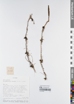
LE 01167544
Bulbophyllum reptans (Lindl.) Lindl. det. Averyanov, Leonid Vladimirovich at 09.05.2000
Коллекторы: Averyanov, Leonid Vladimirovich; et al. Полевой номер образца: VH6151. Дата сбора: 09.05.2000. Административные регионы: VN - Tinh GJak Lak. Группы образцов: L. V. Averyanov specimens; L. V. Averyanov herbarium; Orchids of Vietnam, Laos and CambodiaТекст оригинальной этикетки:FLORA OF VIETNAM
Координаты: 12° 30′ N, 108° 30′ E ±1000 mСоздание записи: 2022-03-03, Galina Savich, PhotoScan D2. Статус обработки: work_status_1Цитирование: Образец LE 01167544 // Виртуальный гербарий Ботанического института им. В. Л. Комарова РАН — http://rr.herbariumle.ru/01167544Orchidaceae
Bulbophyllum reptans
S. Vietnam, Dak Lac Prov., Krong Bong Distr., Cu Pui Municipality, elevation from Dak Tour village (12°30′N, 108°30′E) to main peak of Chu Yang Sinh mt system (12°24′N, 108°26′E) along Dak Tour river (N slope). Primary mossy cloud mixed forest (with Pinus, Fokienia, Dacrydium and Dacrycarpus) on very steep granite slopes at elev. 2100-2200 m. Epiphyte. Very common.
VH 6151 09.05.2000
International Botanical Expedition of the U.S.A. National Geographic Society (grant No 6383-98)
Collectors: L.Averyanov, N.T.Hiep, N.Q.Hieu, P.H.Hoang, D.X.Du, N.T.Vinh
Bulbophyllum reptans
S. Vietnam, Dak Lac Prov., Krong Bong Distr., Cu Pui Municipality, elevation from Dak Tour village (12°30′N, 108°30′E) to main peak of Chu Yang Sinh mt system (12°24′N, 108°26′E) along Dak Tour river (N slope). Primary mossy cloud mixed forest (with Pinus, Fokienia, Dacrydium and Dacrycarpus) on very steep granite slopes at elev. 2100-2200 m. Epiphyte. Very common.
VH 6151 09.05.2000
International Botanical Expedition of the U.S.A. National Geographic Society (grant No 6383-98)
Collectors: L.Averyanov, N.T.Hiep, N.Q.Hieu, P.H.Hoang, D.X.Du, N.T.Vinh
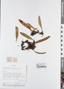
LE 01167543
Bulbophyllum retusiusculum Rchb.f. det. Averyanov, Leonid Vladimirovich at 16.04.2000
Коллекторы: Averyanov, Leonid Vladimirovich; et al. Полевой номер образца: VH5235. Дата сбора: 16.04.2000. Административные регионы: VN - Kon Tum. Группы образцов: L. V. Averyanov specimens; L. V. Averyanov herbarium; Orchids of Vietnam, Laos and CambodiaТекст оригинальной этикетки:FLORA OF VIETNAM
Координаты: 14° 39′ N, 108° 25′ E ±1000 mСоздание записи: 2022-03-03, Galina Savich, PhotoScan D2. Статус обработки: work_status_1Цитирование: Образец LE 01167543 // Виртуальный гербарий Ботанического института им. В. Л. Комарова РАН — http://rr.herbariumle.ru/01167543Orchidaceae
Bulbophyllum retusiusculum
S. Vietnam, Kontum Prov., Kon Plong Distr., Hieu Municipality, Mang La forest enterprise (14°39′N, 108°25′E). Primary evergreen broad-leaved wet forest with Dacrycarpus imbricatus on steep mt. slopes on sandstone & gneiss at elev. 1100-1200 m. Epiphyte on high tree. Common.
VH 5235 16.04.2000
International Botanical Expedition of the U.S.A. National Geographic Society (grant No 6383-98)
Collectors: L.Averyanov, P.K.Loc, P.H.Hoang, D.X.Du, N.T.Vinh
Bulbophyllum retusiusculum
S. Vietnam, Kontum Prov., Kon Plong Distr., Hieu Municipality, Mang La forest enterprise (14°39′N, 108°25′E). Primary evergreen broad-leaved wet forest with Dacrycarpus imbricatus on steep mt. slopes on sandstone & gneiss at elev. 1100-1200 m. Epiphyte on high tree. Common.
VH 5235 16.04.2000
International Botanical Expedition of the U.S.A. National Geographic Society (grant No 6383-98)
Collectors: L.Averyanov, P.K.Loc, P.H.Hoang, D.X.Du, N.T.Vinh